

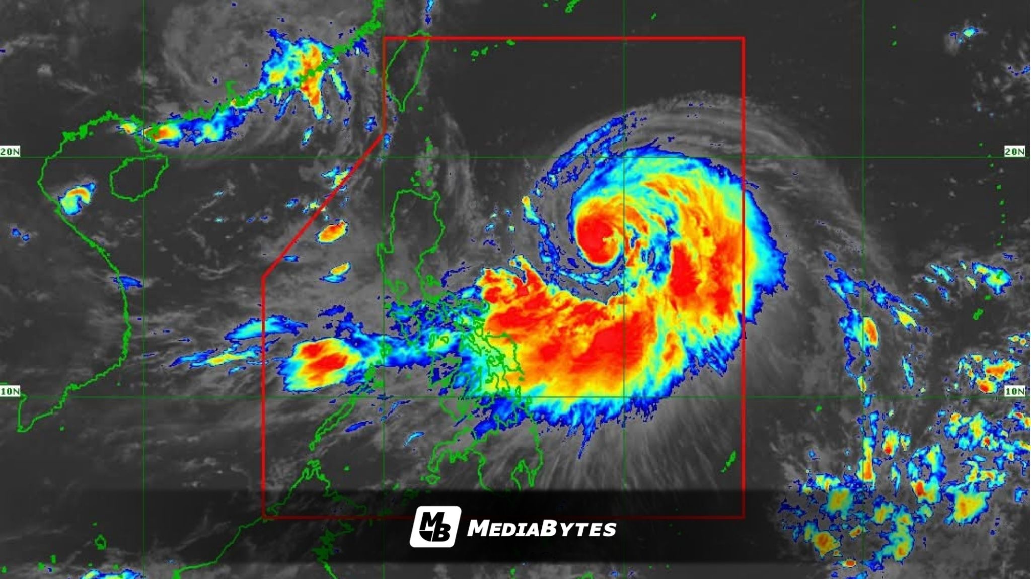
Typhoon “Nando” has picked up strength as it barrels over the Philippine Sea, and weather authorities warn it could reach super typhoon status before making its closest approach to Northern Luzon.
PAGASA reported that as of 10AM Saturday, the storm was last tracked 775 km east of Casiguran, Aurora. Nando is packing maximum sustained winds of 120 kph near the center, gusts of up to 150 kph, and is moving west-northwestward at 10 kph.


With its continued intensification, Tropical Cyclone Wind Signal (TCWS) No. 1 will be hoisted over parts of Northern Luzon and eastern Central Luzon by Saturday afternoon.
Based on the forecast path, the cyclone may either skirt or make landfall over Batanes or the Babuyan Islands by Monday afternoon or evening. It is projected to leave the Philippine Area of Responsibility by Tuesday morning.
Meteorologists are also monitoring the possibility that Nando could reach super typhoon category by Monday while still over the Philippine Sea.
The typhoon’s trough is expected to dump rains and trigger thunderstorms across Cagayan Valley, Bicol Region, Eastern Visayas, Aurora, and Quezon. Meanwhile, the southwest monsoon will enhance rains over Metro Manila, Mimaropa, Pangasinan, the rest of Central Luzon, and Calabarzon.
The rest of the country can expect partly cloudy to cloudy skies with isolated rain showers or thunderstorms, either from the monsoon or localized weather systems.
As for sea conditions, PAGASA warned that the eastern seaboards of Luzon will experience moderate to strong winds and moderate to rough seas, while the northern coastline of Luzon will have moderate winds and moderate seas. The rest of the archipelago will generally see light to moderate winds and slight to moderate seas.