

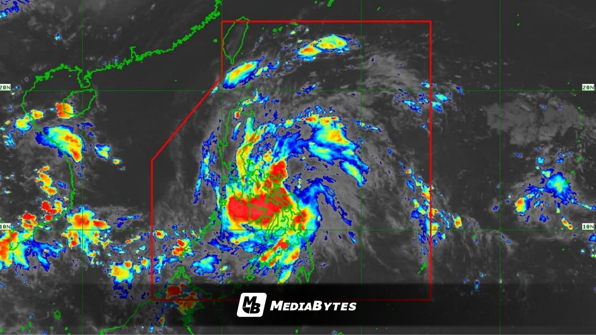
Tropical Storm Ramil made landfall over Gubat, Sorsogon at 4:10 p.m. on Saturday, the Philippine Atmospheric, Geophysical and Astronomical Services Administration (PAGASA) reported.
As of the latest update, the storm’s center was located over the coastal waters of Gubat, bringing maximum sustained winds of 65 kilometers per hour (kph) and gusts of up to 90 kph. PAGASA said Ramil is moving slowly westward, with strong to gale-force winds extending outward up to 400 kilometers from its center.


WIND SIGNALS IN EFFECT
Tropical Cyclone Wind Signal No. 2 has been hoisted over:
- southeastern portion of Isabela
- southern portion of Quirino
- southern portion of Nueva Vizcaya, northern and central portion of Aurora
- Polillo Islands
- Camarines Norte
- Catanduanes
- northern and eastern portion of Camarines Sur
- eastern portion of Albay
- northeastern portion of Sorsogon
- northern portion of Northern Samar.
Meanwhile, Signal No. 1 is raised over:
- Cagayan including Babuyan Islands
- rest of Isabela
- rest of Quirino
- rest of Nueva Vizcaya
- Apayao
- Abra
- Kalinga
- Mountain Province
- Ifugao
- Benguet
- Ilocos Norte
- Ilocos Sur
- La Union
- Pangasinan
- rest of Aurora
- Nueva Ecija
- eastern portion of Bulacan
- eastern portion of Tarlac
- eastern portion of Pampanga
- northern and eastern portion of Quezon
- rest of Camarines Sur
- rest of Albay
- rest of Sorsogon
- Burias Island
- Ticao Island
- rest of Northern Samar
- northern portion of Eastern Samar
PROJECTED PATH AND IMPACT
According to PAGASA, Ramil will likely move west-northwestward across the Bicol Region, passing either over land or along its coastal areas before approaching the Polillo Islands by Sunday morning.
The storm is then expected to make a second landfall in Aurora Province on Sunday morning or afternoon. After crossing Northern Luzon’s mountainous areas, it is forecast to emerge over the coastal waters of Pangasinan or La Union by Sunday evening and exit the Philippine Area of Responsibility (PAR) by Monday morning.
In its latest forecast, PAGASA said “due to its proximity to the sea and the absence of large mountain ranges in Bicol Region, a re-intensification scenario before the final landfall in Aurora within the next 24 hours is likely. During its passage over Northern Luzon, Ramil may maintain its strength or slightly weaken due to frictional effects of the mountainous landmass. Once over the West Philippine Sea, further re-intensification is highly likely.”
Residents in affected areas are advised to remain vigilant against possible flooding, landslides, and strong winds as Ramil continues its path across the country.