

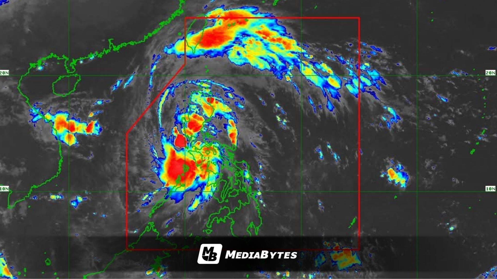
Tropical Storm Ramil continued to hover over the coastal waters of Quezon province on Sunday morning, sustaining its strength while moving across parts of Luzon.
Based on the 7 a.m. advisory from PAGASA, the storm’s center was located off the coast of Mauban, Quezon, packing maximum sustained winds of 65 kilometers per hour near the center and gusts reaching up to 90 kph. It is moving west-northwestward at 20 kph.


Wind Signals Raised
Signal No. 2 remains in effect over 17 areas, namely:
- northern portion of Metro Manila
- southeastern portion of Quirino
- central and southern portion of Nueva Vizcaya
- central and southern portion of Benguet
- central and southern portion of La Union
- Pangasinan
- Aurora
- Nueva Ecija
- Bulacan
- Tarlac
- Pampanga
- northern and central portion of Zambales
- northern and central portion of Rizal
- northern portion of Laguna
- northern and eastern portion of Quezon including Polillo Islands
- Camarines Norte
- northwestern portion of Camarines Sur
Meanwhile, Signal No. 1 has been raised in 30 other areas, including the rest of Metro Manila, Southern Luzon, and parts of Eastern Visayas, as the storm’s wide circulation continues to bring gusty winds and scattered to widespread rainfall.
According to PAGASA, Ramil will make another landfall in Quezon province within the day before traversing Southern-Central Luzon. The system is forecast to emerge over the West Philippine Sea by late Sunday afternoon or evening, and exit the Philippine Area of Responsibility (PAR) by Monday morning or around noon.
The storm is expected to unleash moderate to heavy rains, with intense downpours possible in Nueva Vizcaya, Quirino, Aurora, Southern Luzon, and western Panay.
Residents in flood-prone and mountainous areas are urged to prepare for possible flash floods and landslides, as widespread flooding may occur due to continuous rainfall and saturated soil conditions.
Local disaster risk reduction offices have been advised to remain on alert and to coordinate closely with PAGASA for updates and possible evacuations.