

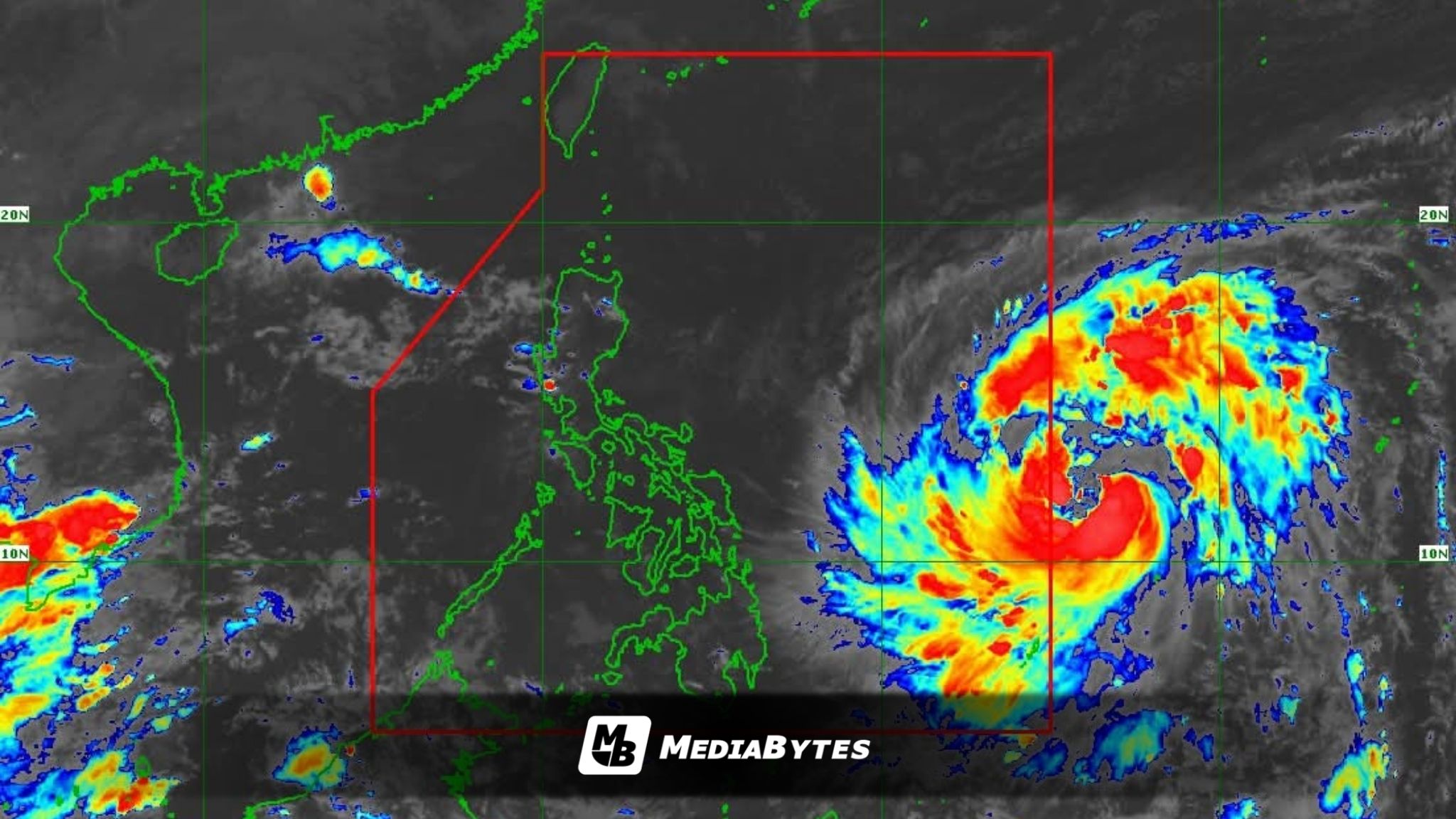
Severe Tropical Storm Uwan has continued to intensify after entering the Philippine Area of Responsibility (PAR), according to the latest weather bulletin issued by the Philippine Atmospheric, Geophysical and Astronomical Services Administration (PAGASA).
As of 5 p.m. Friday, Uwan was estimated 1,175 kilometers east of Eastern Visayas, packing maximum sustained winds of 110 kilometers per hour (km/h) near the center and gustiness of up to 135 km/h. The storm is moving westward at 25 km/h, with strong to storm-force winds extending outward up to 780 kilometers from its center.

PAGASA said the cyclone is forecast to intensify into a typhoon within 24 hours and may reach super typhoon category by Saturday evening or Sunday morning. It is expected to make landfall over the southern portion of Isabela or the northern portion of Aurora late Sunday or early Monday, before crossing Northern Luzon and moving over the West Philippine Sea.
Tropical Cyclone Wind Signal (TCWS) No. 1 is currently raised over the southeastern portion of Quezon, eastern Romblon, Camarines Norte, Camarines Sur, Catanduanes, Albay, Sorsogon, and Masbate.

In the Visayas, Signal No. 1 covers Northern Samar, Eastern Samar, Samar, Biliran, Leyte, Southern Leyte, parts of Cebu including Bantayan and Camotes Islands, the northeastern portion of Bohol, the northern portion of Negros Occidental, and portions of Capiz and Iloilo.
In Mindanao, Dinagat Islands and Surigao del Norte are under the same warning level.
Areas under Signal No. 1 are expected to experience strong winds between 39 and 61 kph within 36 hours, while the highest possible wind signal that may be raised during Uwan’s passage is Signal No. 5.
PAGASA warned that the storm will also bring occasional gusty conditions reaching strong to gale-force strength over Palawan, Visayas, and Mindanao during the weekend.
Life-threatening storm surges and coastal flooding are expected along the east coast of Central and Southern Luzon and parts of Northern Luzon, with storm surge warnings to be issued Friday night or Saturday.
A gale warning will also be raised for the eastern seaboards of Luzon, Visayas, and the Caraga Region, with sea conditions reaching up to five meters, making sea travel extremely dangerous for all types of vessels.
After crossing Northern Luzon, Uwan is projected to weaken but remain a typhoon as it exits toward the West Philippine Sea by Monday.