

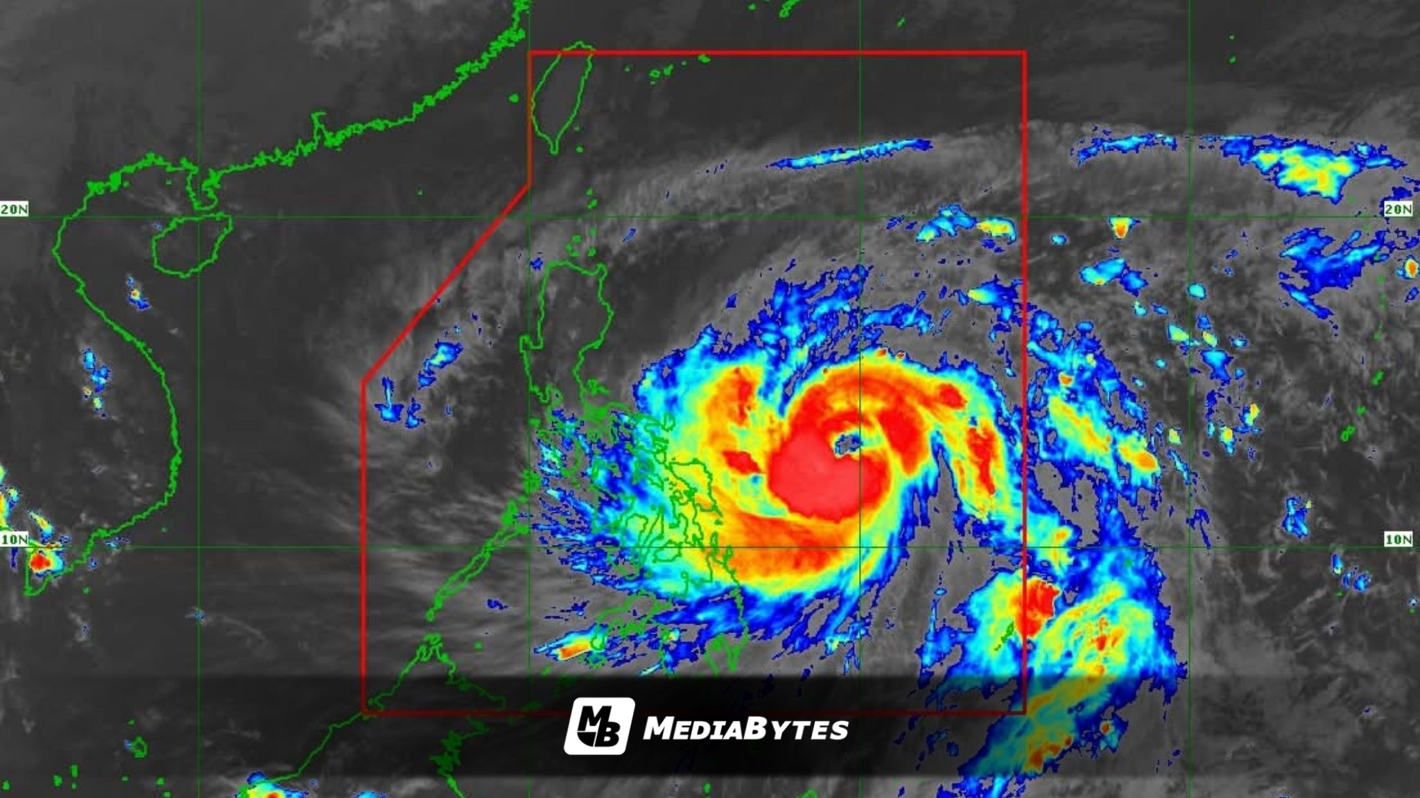
Typhoon Uwan continues to intensify rapidly as it moves closer to the Philippine Sea, east of the Bicol Region, the Philippine Atmospheric, Geophysical and Astronomical Services Administration (PAGASA) said on Saturday afternoon.
According to PAGASA’s 5 p.m. bulletin, Uwan’s center was estimated at 575 kilometers east of Catarman, Northern Samar, or 620 km east of Virac, Catanduanes. The typhoon is moving west-northwest at 30 km/h, packing maximum sustained winds of 150 km/h near the center and gustiness of up to 185 km/h.


Tropical Cyclone Wind Signal No. 3 has been raised over Catanduanes and parts of Camarines Sur, Albay, Sorsogon, and Northern Samar. Meanwhile, Signal No. 2 is in effect over several provinces in Luzon and the Visayas, including Metro Manila, Quezon, Aurora, and Northern Samar. The rest of Central Luzon, Southern Tagalog, and parts of Visayas and Mindanao are under Signal No. 1.

PAGASA said Uwan is expected to move west-northwestward through Sunday before shifting northwest by Monday. The typhoon’s eye may pass near Catanduanes by Sunday morning and could make landfall over the southern part of Isabela or northern Aurora by Sunday evening or early Monday.

After crossing Northern Luzon, Uwan is forecast to emerge over the Lingayen Gulf or coastal waters of Pangasinan or La Union by Monday afternoon.
PAGASA warned that Uwan could reach super typhoon strength by Saturday night or Sunday, though its intensity may weaken once it interacts with Luzon’s mountainous terrain. Despite this, the weather bureau said it will likely remain a typhoon while moving across Northern Luzon.