

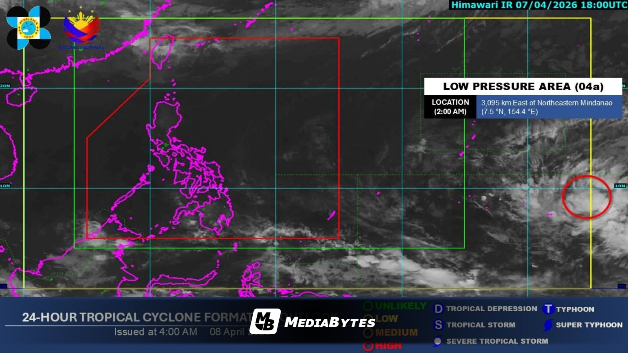
The Philippine Atmospheric, Geophysical and Astronomical Services Administration (PAGASA) reported Wednesday that a low-pressure area (LPA) outside the Philippine Area of Responsibility (PAR) could intensify into a tropical cyclone within the next 24 hours.
As of 2 a.m., the system was located about 3,095 kilometers east of northeastern Mindanao. PAGASA clarified that the LPA remains too far to directly affect local weather conditions at this time.
Instead, most parts of the country will continue to experience hot and humid weather.
PAGASA weather specialist Aldczar Aurelio noted, “Warm and humid weather will prevail on Wednesday,” though localized thunderstorms may still develop in some areas.
Forecasts show temperatures reaching up to 36°C in Tuguegarao, while Metro Manila and Davao City may record highs of 35°C. The heat index—an indicator of how hot it feels when humidity is factored in—could climb to dangerous levels, hitting 42°C in Cotabato City, Maguindanao, and Butuan City, Agusan del Norte. In Metro Manila, the heat index may reach 37°C.
Light to moderate winds and slight to moderate sea conditions are expected across the archipelago. Authorities continue to closely monitor the LPA’s movement and potential development in the coming hours.