


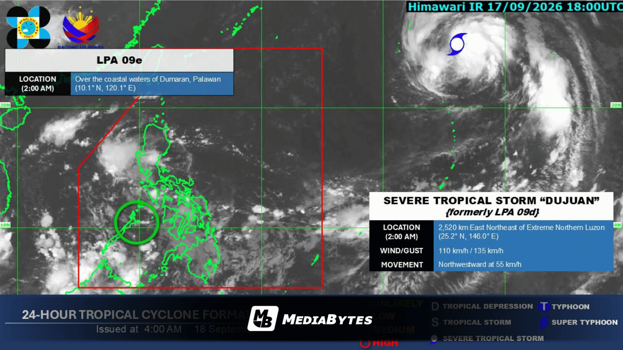
A low pressure area (LPA) situated off the coast of Dumaran, Palawan is expected to bring overcast skies and scattered precipitation to several regions on Friday, September 18, according to state weather bureau PAGASA.
PAGASA weather specialist Obet Badrina shared in an interview with DZRH that the system faces a low probability of intensifying into a tropical depression within the next 24 hours. The weather disturbance is forecasted to track westward across the West Philippine Sea, where it will likely weaken and eventually dissipate over the weekend.
Despite its low chance of intensification, the LPA will continue to bring cloudy conditions, scattered rain showers, thunderstorms, and lightning to Mimaropa, the Bicol Region, Visayas, Batangas, Quezon, Northern Mindanao, and the Zamboanga Peninsula.
Meanwhile, Metro Manila and much of the country can expect generally fair weather throughout the day. While early morning rain chances remain minimal in the capital, localized afternoon thunderstorms are still possible.
Outside the Philippine Area of Responsibility (PAR), PAGASA is tracking Severe Tropical Storm Dujuan (formerly designated as LPA 09d).
As of 3 a.m., the storm was spotted roughly 2,460 kilometers east-northeast of extreme Northern Luzon, packing maximum sustained winds of 110 km/h with gusts reaching up to 135 km/h. Moving northwestward at 55 km/h, the storm is not projected to enter the PAR or directly impact the country.
Fair weather conditions are slated to prevail over most of the archipelago through the weekend, with no torrential downpours anticipated and no gale warnings currently raised, keeping sea travel safe.
However, a weak southwest monsoon may still trigger light rains in Western Samar and neighboring areas after the LPA dissipates.