


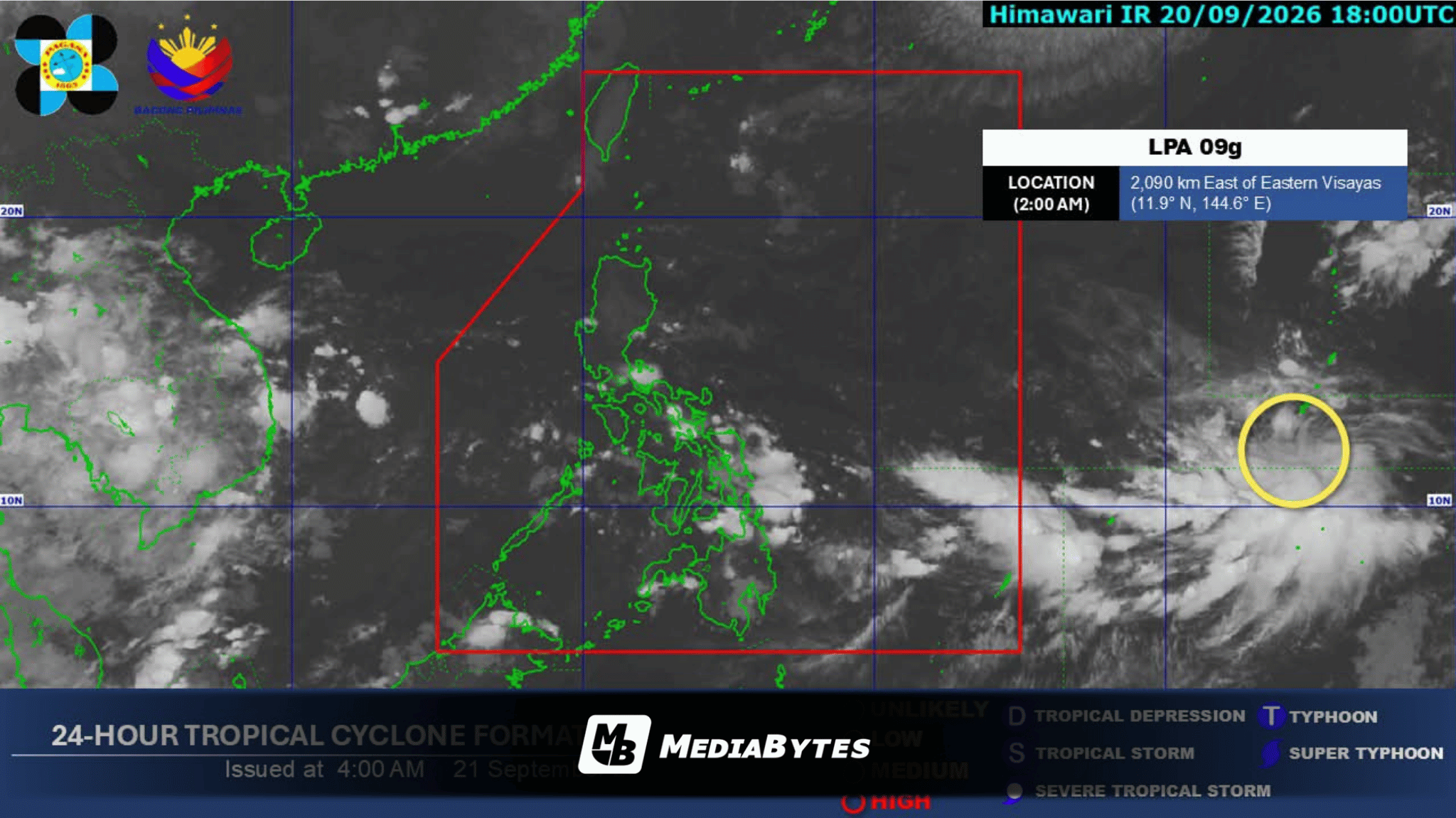
QUEZON CITY, Philippines — The Philippine Atmospheric, Geophysical and Astronomical Services Administration (PAGASA) reported on Monday, September 21, that a low-pressure area (LPA) detected east of Visayas is expected to enter the Philippine Area of Responsibility (PAR) within the week.
According to the state weather bureau’s 5 a.m. forecast, the LPA formed around 2 a.m. over 2,000 kilometers east of the Visayas.
Weather specialist Aldczar Aurelio noted that the system could enter PAR by Tuesday or Wednesday and potentially intensify into a tropical depression by Thursday, September 24, or Friday, September 25.
Upon entering PAR, the system will be assigned the domestic name “Queenie”. As of Monday morning, the LPA has no direct effect on the country’s prevailing weather patterns.
Meanwhile, a weak southwest monsoon, locally known as Habagat, continues to bring scattered rainfall over the western portion of Southern Luzon. Aurelio explained:
”Base sa ating mga data, patuloy din ang makakapekto ang mahinang habagat sa western section ng southern Luzon sa susunod na tatlong araw”
Fair and warm weather with occasional sunshine will prevail across Luzon, Visayas, and Mindanao, though brief afternoon or evening downpours remain possible due to localized thunderstorms.
PAGASA added that no gale warnings have been raised, indicating safe conditions for coastal waters across the archipelago.