


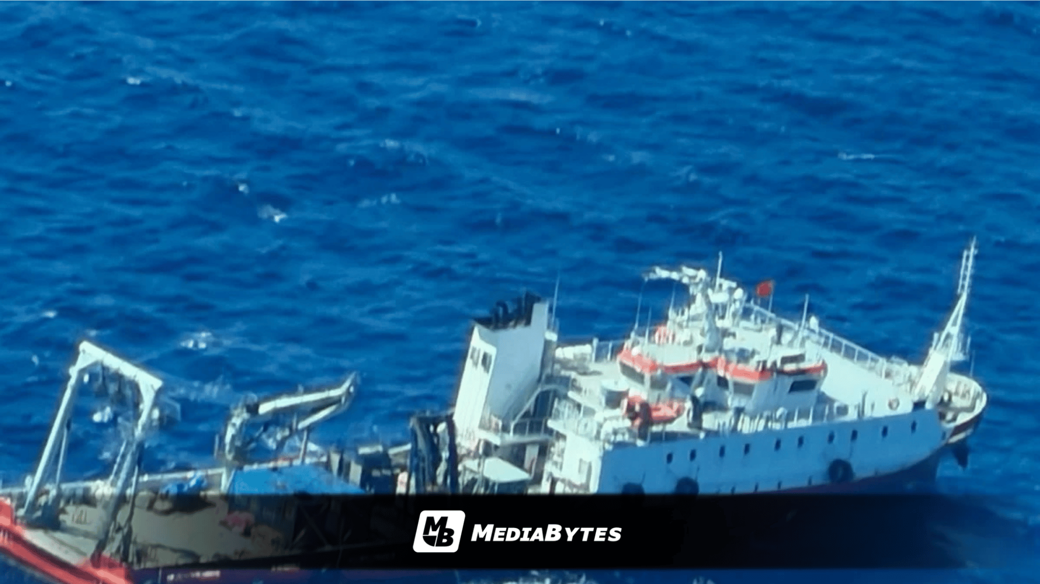
MANILA, Philippines — The Philippine Coast Guard (PCG) has heightened its maritime surveillance across the country’s northern waters after discovering a Chinese research ship near Batanes suspected of falsifying its location to conceal unauthorized seabed survey activities.
The Chinese-flagged research ship, identified as the JIA HAI KE 7, was spotted roughly 37.84 nautical miles northwest of Itbayat during a Maritime Domain Awareness (MDA) aerial flight on Monday. PCG Commandant Admiral Ronnie Gil Gavan ordered the reconnaissance effort after a land-based monitoring station in Itbayat first flagged the vessel’s presence.
Personnel aboard the PCG aircraft issued multiple radio calls directing the vessel to state its purpose, halt unapproved operations, and respect Philippine sovereignty. The crew of the JIA HAI KE 7 failed to reply.
Coast guard officials noted that the vessel was not executing standard innocent passage, as it lingered in a localized area instead of maintaining a steady route and velocity. The ship’s maneuvers strongly suggest it was conducting marine scientific research, specifically underwater topography surveys.
Concerns intensified after standard tracking failed to detect the vessel. A subsequent analysis using Canada’s Dark Vessel Detection (DVD) system uncovered a physically impossible Automatic Identification System (AIS) log.
While ship records showed the vessel departing Xiamen, Fujian, early on September 21, its broadcasted AIS coordinates placed it near Bindari, Papua New Guinea—over 2,000 nautical miles away—just nineteen hours later. By Monday morning, its tracking data abruptly placed it back in the waters off Itbayat.
The PCG concluded the erratic tracking records were likely the result of intentional AIS location spoofing, a practice that violates Safety of Life at Sea (SOLAS) regulations requiring continuous, accurate position transmissions.
PCG spokesperson for the West Philippine Sea Rear Adm. Jay Tarriela detailed that the 2,000-ton, 70-meter ship entered service in April 2025 under Zhuhai Jiahai Marine Technology Co. as China’s first privately owned research craft outfitted with DP-2 dynamic positioning and low-noise electric propulsion—tech engineered to hold precise positions for seabed drilling and mapping.
Tarriela cautioned that the vessel’s location poses a direct threat to strategic national assets.
”The waters off Batanes and the Luzon Strait host critical submarine cable corridors linking the Philippines to Northeast Asia and the wider Indo-Pacific,” Tarriela said.
”A seabed-survey vessel hiding its position while holding station in this corridor raises serious concern over the security of the country’s undersea communications infrastructure and the potential military use of the data collected,” he warned.