


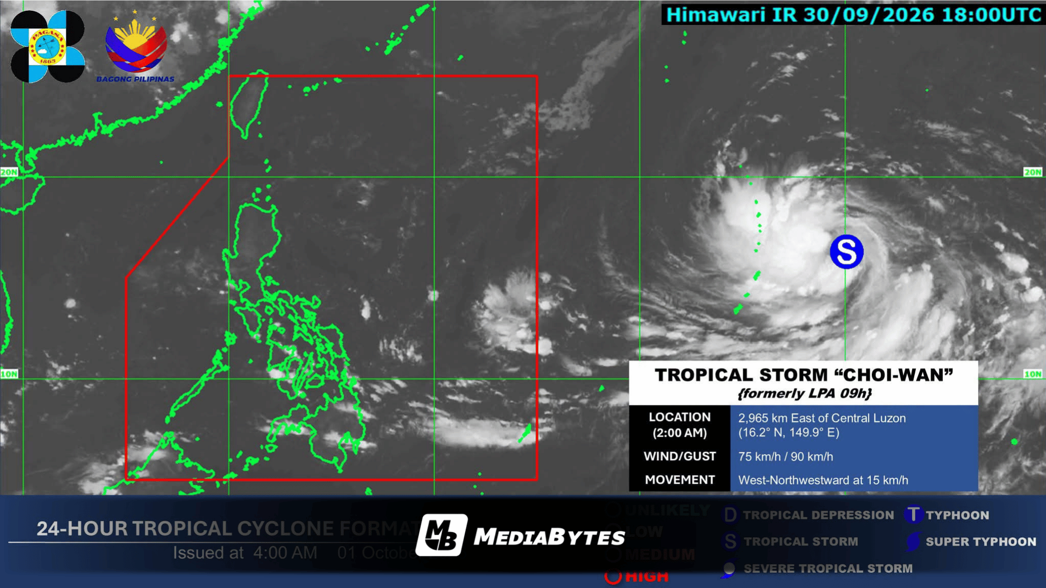
MANILA, Philippines — The extended cloud band, or trough, of Tropical Storm Choi-Wan will bring overcast skies, scattered rainfall, and thunderstorms across select areas in Visayas and Mindanao on Thursday, October 1.
According to the Philippine Atmospheric, Geophysical and Astronomical Services Administration (PAGASA), the storm’s trough is expected to trigger cloudy conditions accompanied by scattered rain showers and thunderstorms over Eastern Visayas, Caraga, and Davao Oriental.
Meanwhile, Northern Mindanao and the remainder of the Davao Region will experience partly cloudy to cloudy skies, with light, localized rain showers or sudden thunderstorms.
In Metro Manila and the rest of the country, similar partly cloudy to overcast conditions with isolated rain showers or localized thunderstorms are anticipated throughout the day.
Weather trackers recorded Tropical Storm Choi-Wan at 2,945 kilometers east of Central Luzon as of 3:00 a.m. Thursday. The cyclone is currently packing maximum sustained winds of 75 kilometers per hour near its center, with gusts reaching up to 90 kph.
Moving west-northwestward at a speed of 15 kph, the tropical cyclone remains outside the Philippine Area of Responsibility (PAR).
PAGASA confirmed that it continues to actively monitor the storm’s trajectory and potential impacts on nationwide weather patterns.