


MANILA, Philippines — Several parts of the country are expected to experience rains and thunderstorms on Monday, October 12, due to the Intertropical Convergence Zone (ITCZ) and easterlies, according to the Philippine Atmospheric, Geophysical and Astronomical Services Administration (PAGASA).
In its 4 a.m. weather bulletin, PAGASA reported that the ITCZ is affecting Southern Luzon, the Visayas, and Mindanao, while easterlies are bringing weather disturbances to the eastern portions of Northern and Central Luzon.
The agency forecast cloudy skies with scattered rain showers and thunderstorms over the Bicol Region, MIMAROPA, Western Visayas, Negros Island Region, Central Visayas, Caraga, Northern Mindanao, the Zamboanga Peninsula, Leyte, and Southern Leyte.
Batanes and the Babuyan Islands may also experience cloudy skies and rainfall due to the northeasterly windflow.
Meanwhile, Metro Manila, CALABARZON, Central Luzon, Isabela, Quirino, Nueva Vizcaya, Benguet, and Pangasinan are expected to have cloudy conditions accompanied by scattered rains and thunderstorms brought by the easterlies.
Other parts of Luzon, the Visayas, and Mindanao may experience partly cloudy to cloudy skies, with isolated rain showers or thunderstorms throughout the day.
PAGASA cautioned residents in areas experiencing moderate to occasionally heavy rainfall to remain alert for possible flash floods and landslides. Similar hazards may occur in other locations affected by severe thunderstorms.
For coastal conditions, moderate seas with wave heights of 1.5 to 2.5 meters are forecast over Northern Luzon, Central Luzon, and the western portion of Southern Luzon.
Slight to moderate sea conditions, with waves reaching 0.6 to 1.8 meters, are expected across the Visayas, the remaining parts of Luzon, and Mindanao.
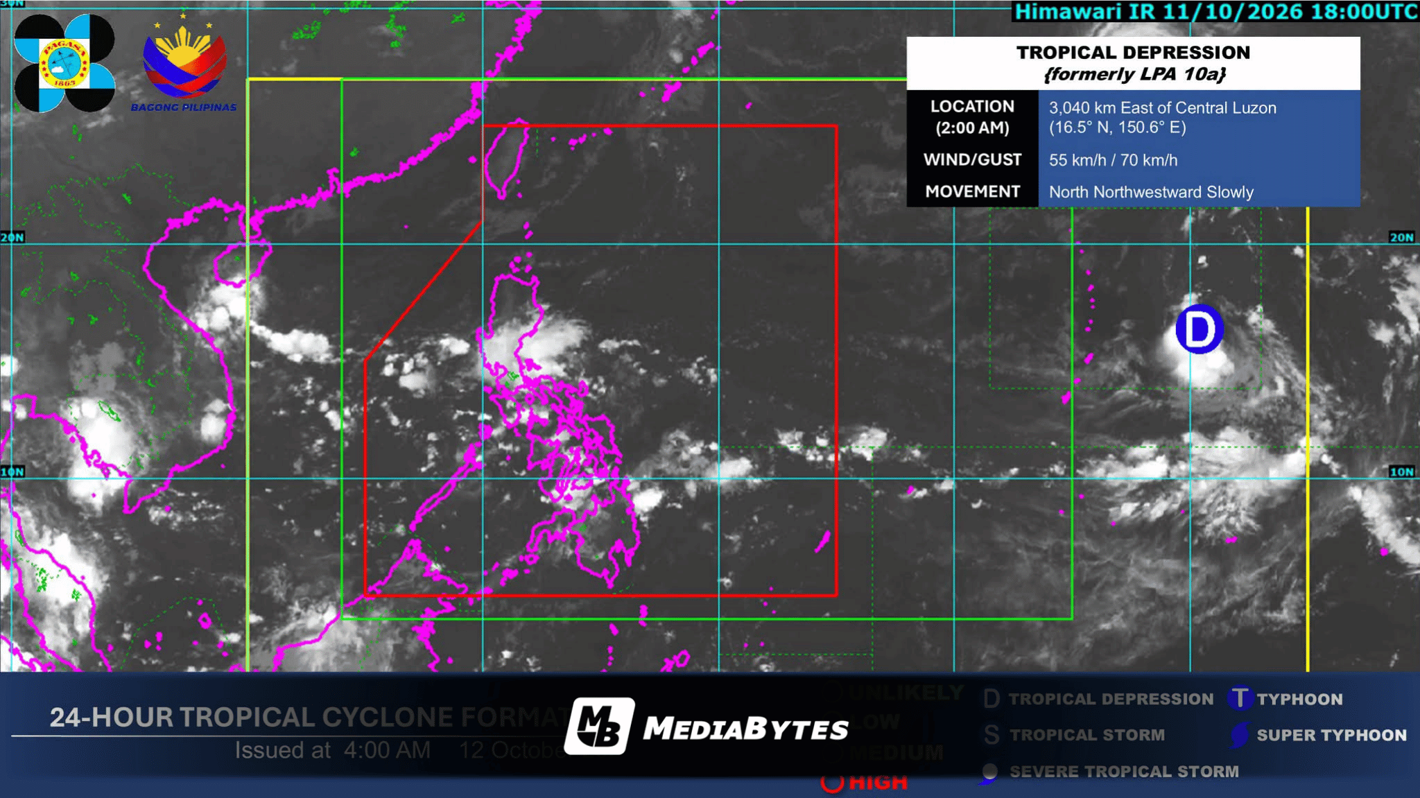
Tropical depression monitored outside PAR
As of 3 a.m. on Monday, PAGASA was also monitoring a tropical depression located outside the Philippine Area of Responsibility (PAR).
The weather disturbance was spotted approximately 3,030 kilometers east of Central Luzon, carrying maximum sustained winds of 55 kilometers per hour and gusts reaching 70 kph.
PAGASA said the tropical depression was moving slowly in a north-northwesterly direction.