


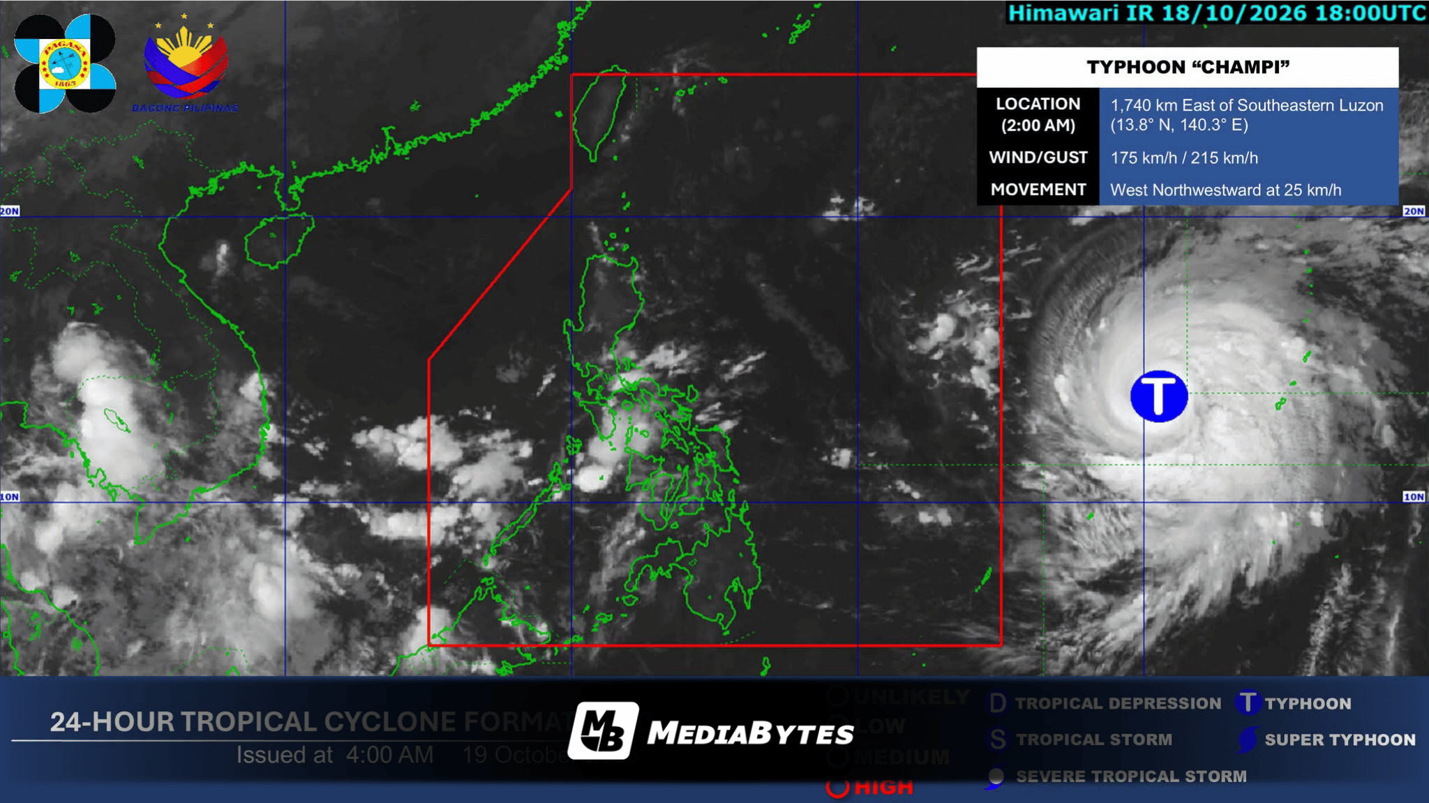
MANILA, Philippines — Typhoon Champi remains outside the Philippine Area of Responsibility (PAR) on Monday morning, but state weather bureau PAGASA warns it could intensify back into a super typhoon before entering the country on Tuesday, where it will be locally named Rosal.
Speaking during a television interview on Monday, October 19, PAGASA weather specialist Charmagne Varilla announced the expected timeline for the cyclone’s entry.
“Inaasahan na natin ang pagpasok nito sa loob ng PAR bukas ng umaga at hapon at papangalanan natin ‘yan na Bagyong Rosal,” Varilla said.
Although Champi reached super typhoon intensity early Sunday before weakening slightly into a typhoon by Sunday night, forecasters note that its re-intensification is likely once it moves inside the PAR boundary.
“Pero pagpasok nito sa PAR, posibleng bumalik at maging super typhoon muli,” Varilla added.
Authorities are also closely monitoring a potential landfall scenario over Extreme Northern Luzon or the Cagayan Valley region.
“We are still also not ruling out pagla-landfall nito dahil pasok ang cone of probability dito sa bahagi ng Extreme Northern Luzon so posible yan as far as Cagayan Valley,” Varilla explained.
As of 3:00 a.m. on Monday, the center of Typhoon Champi was tracked 1,720 kilometers east of Southeastern Luzon, packing maximum sustained winds of 175 kilometers per hour near the center and gusts of up to 215 kilometers per hour while moving west-northwestward at 25 kilometers per hour.
While Champi has no direct weather impact yet, PAGASA reported that the Intertropical Convergence Zone (ITCZ) will bring cloudy skies and scattered rain showers over Palawan and the western section of Mindanao, while easterlies will prevail across the Visayas and the rest of Luzon.