


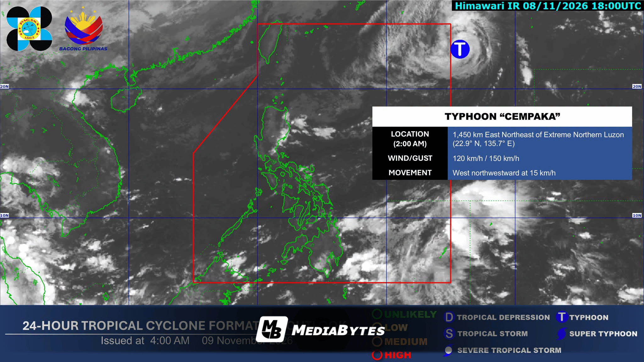
Typhoon Cempaka is anticipated to enter the Philippine Area of Responsibility (PAR) on Monday and will be locally named Samuel upon entry, according to the Philippine Atmospheric, Geophysical and Astronomical Services Administration (PAGASA).
As of 3 a.m., the typhoon was spotted 1,440 kilometers east-northeast of extreme Northern Luzon, packing maximum sustained winds of 120 km/h near the center and gusts of up to 150 km/h. It is moving west-northwestward at 15 km/h.
“Ang Bagyong Cempaka ay unti-unting lumalapit sa Philippine Area of Responsibility,” said DOST-PAGASA weather specialist Aldczar Aurelio.
Forecasters noted that the cyclone is not projected to make landfall or directly affect the country’s weather, and it is expected to exit PAR quickly by Monday night or Tuesday morning. It will also not intensify into a super typhoon and may weaken by Wednesday.
“Hindi natin ito inaasahang makakaapekto sa ating lagay ng panahon. Hindi natin inaasahang magla-landfall o lalapit sa ating bansa,” Aurelio added.
However, weather officials indicated that the storm’s approach may enhance the Northeast Monsoon (Amihan), potentially lowering temperatures and extending its reach toward the CALABARZON region.
“Sa nakikita po natin dahil sa paglapit nitong bagyo ay bahagyang lumakas ang Amihan natin kaya naman ngayon hanggang sa susunod na araw, ang Amihan natin ay makakaabot dito sa may part ng Calabarzon,” weather specialist Varilla stated.
Weather Outlook
- Northeast Monsoon (Amihan): Expect cloudy skies with rains over Cagayan, Isabela, Quirino, Apayao, Kalinga, Mountain Province, Ifugao, Aurora, and Quezon, with possible flash floods or landslides due to moderate to heavy rains. Metro Manila, Ilocos Region, and parts of Central Luzon and CALABARZON will see partly cloudy skies with isolated light rains.
- Easterlies: Scattered rains and thunderstorms will affect Caraga, Camarines Norte, Camarines Sur, Catanduanes, Albay, Sorsogon, Davao Oriental, and Davao Occidental. The rest of the country will experience isolated rain showers.
- Coastal and Wind Conditions: Northern Luzon and the eastern sections of Central and Southern Luzon will experience moderate to strong winds with moderate to rough coastal waters. The rest of the country can expect light to moderate winds and slight to moderate coastal conditions.