

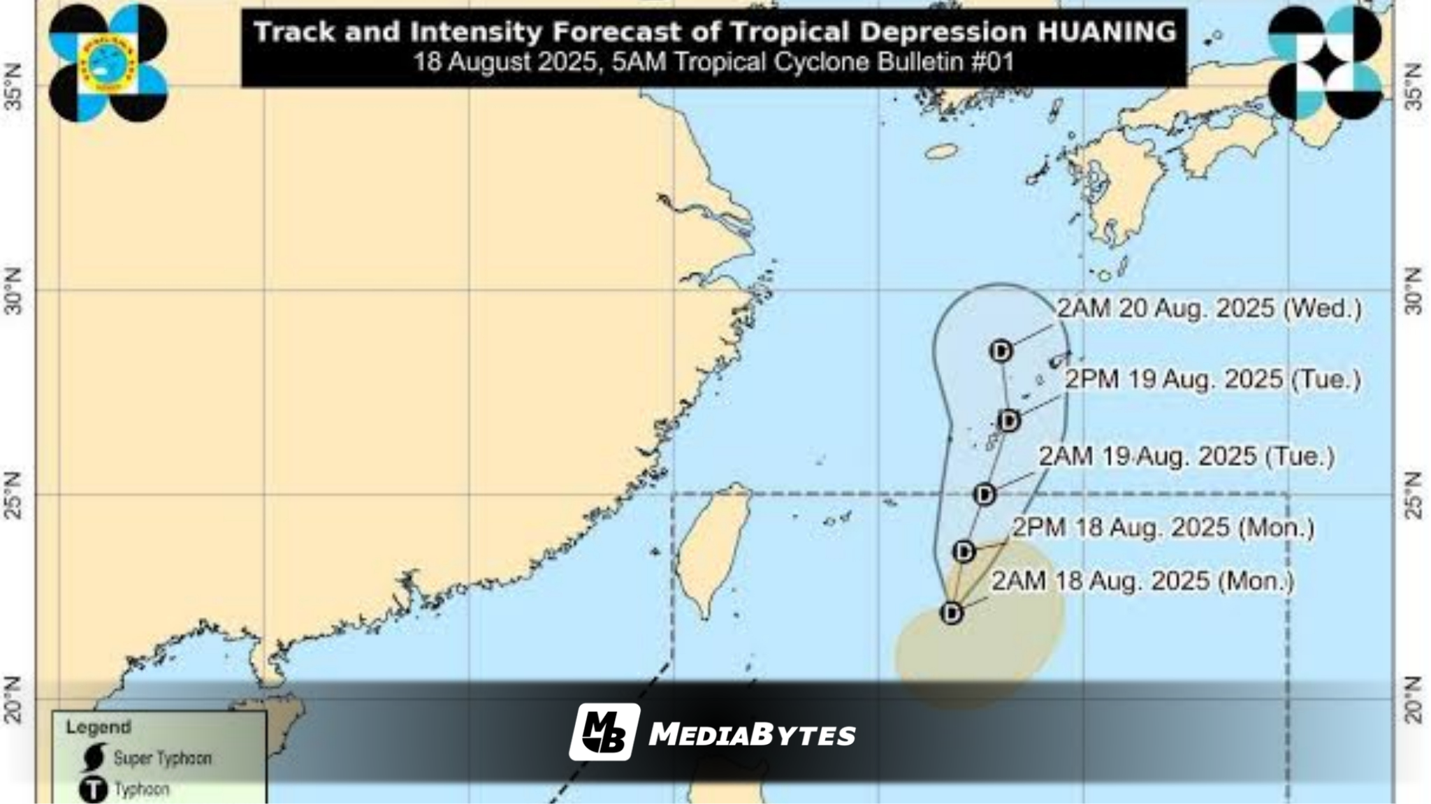

The low-pressure area (LPA) inside the Philippine Area of Responsibility (PAR) has strengthened into a tropical depression at 2 a.m. Monday, and has been named Huaning, according to PAGASA.
In its 5 a.m. tropical cyclone bulletin, PAGASA reported that at 4 a.m., the center of Huaning was estimated at 520 km east northeast of Itbayat, Batanes.
Huaning carries maximum sustained winds of 45 km/h near the center, gustiness of up to 55 km/h, and a central pressure of 1008 hPa. It is moving north northwestward at 10 km/h.
Strong winds extend outward up to 270 km from its center, but no Tropical Cyclone Wind Signals (TCWS) have been raised.
PAGASA stressed: “HUANING is unlikely to directly affect the country within the next 48 hours.”
Still, the Ilocos Region, Zambales, and Bataan will experience cloudy skies with scattered rains and thunderstorms due to Huaning’s trough or extension. Residents are warned of possible flash floods or landslides from moderate to at times heavy rains.
Meanwhile, moderate seas of up to 2.0 meters will affect the following areas on Monday:
- Seaboards of Batanes
- Northern and western seaboards of Babuyan Islands
- Northwestern and western seaboards of Ilocos Norte
- Western seaboards of Ilocos Sur, Pangasinan, Zambales, Bataan, Occidental Mindoro, Lubang Island, and Palawan
PAGASA advised: “Mariners of motor bancas and similarly sized vessels are advised to take precautionary measures while venturing out to sea and, if possible, avoid navigating in these conditions.”
Huaning is expected to track northward until Monday night, before shifting north northeastward by early Tuesday toward the Ryukyu Islands in Japan. The system is forecast to exit PAR between late Monday evening and Tuesday morning.
The next tropical cyclone bulletin will be released at 11 a.m.