

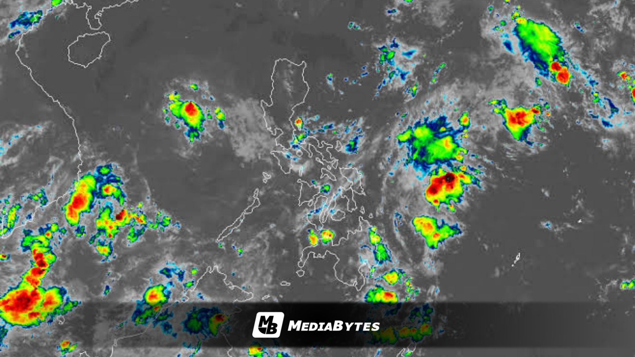
The country’s weather bureau has warned of a potential weather disturbance that could develop east of Mindanao early next week, which may bring rain showers to several parts of the country.
According to the Philippine Atmospheric, Geophysical and Astronomical Services Administration (PAGASA), a low pressure area (LPA) is expected to form by Monday near the eastern boundary of the Philippine Area of Responsibility (PAR).
While it remains uncertain whether the system will enter the country’s monitoring area, its associated trough is already forecast to influence weather conditions in nearby regions.
The trough of the potential LPA may bring scattered rain showers and isolated thunderstorms over Northern Mindanao and the Caraga Region. Weather conditions with similar rain patterns are also expected in Quezon, Oriental Mindoro, Marinduque, the Bicol Region, and parts of the Visayas, mainly due to the shear line.
From Tuesday until Thursday, residents in Mindanao and Eastern Visayas may experience cloudy skies accompanied by scattered rain showers and thunderstorms. By Friday, the trough linked to the LPA could continue affecting Surigao del Sur and Davao Oriental, keeping weather conditions wet in those areas.
PAGASA noted that it has yet to determine whether the weather disturbance will fully develop or move inside the PAR. However, its trough may continue to influence weather conditions across portions of the country through the end of the week.
Aside from the potential LPA, PAGASA also said that the shear line, the northeast monsoon (amihan), and localized thunderstorms may bring additional rain to several areas across the country next week.