

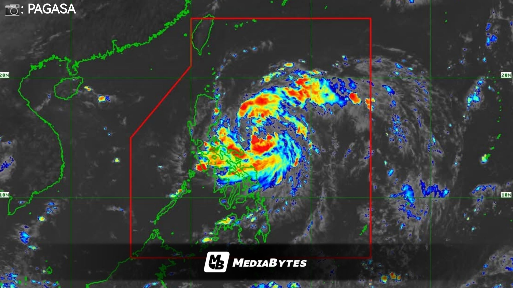
Tropical Storm Paolo has slightly intensified as it continues to move across the Philippine Sea.
According to PAGASA, the storm’s center was last located 575 kilometers east of Infanta, Quezon. Paolo is packing maximum sustained winds of 75 km/h near the center with gusts reaching up to 90 km/h. It is moving west-northwest at a speed of 20 km/h.


Tropical Cyclone Wind Signal (TCWS) No. 2:
- southeastern portion of Isabela
- northern portion of Quirino
- northern portion of Aurora
Tropical Cyclone Wind Signal (TCWS) No. 1:
- Mainland Cagayan
- rest of Isabela
- Quirino
- Nueva Vizcaya
- Apayao
- Abra
- Kalinga
- Mountain Province
- Ifugao
- Benguet
- Ilocos Norte
- Ilocos Sur
- La Union
- Pangasinan
- northern portion of Zambales
- Tarlac
- Nueva Ecija
- rest of Aurora
- northern portion of Bulacan
- northern portion of Pampanga
- northern portion of Quezon
- northern portion of Catanduanes
PAGASA said a gale warning may be raised over the seaboards of Northern and Central Luzon by Thursday afternoon due to rough to very rough sea conditions associated with Paolo’s passage.
The agency also warned of a “moderate risk of life-threatening storm surge” with peak heights reaching 1 to 2 meters within 36 hours, affecting low-lying and exposed coastal areas of Ilocos Norte, Cagayan, Isabela, Aurora, Quezon, Camarines Norte, Camarines Sur, and Catanduanes.
Paolo is forecast to intensify further and could reach severe tropical storm category by Thursday night. PAGASA added that the cyclone may possibly make landfall over southern Isabela or northern Aurora by Friday, before exiting the Philippine Area of Responsibility on Saturday.