

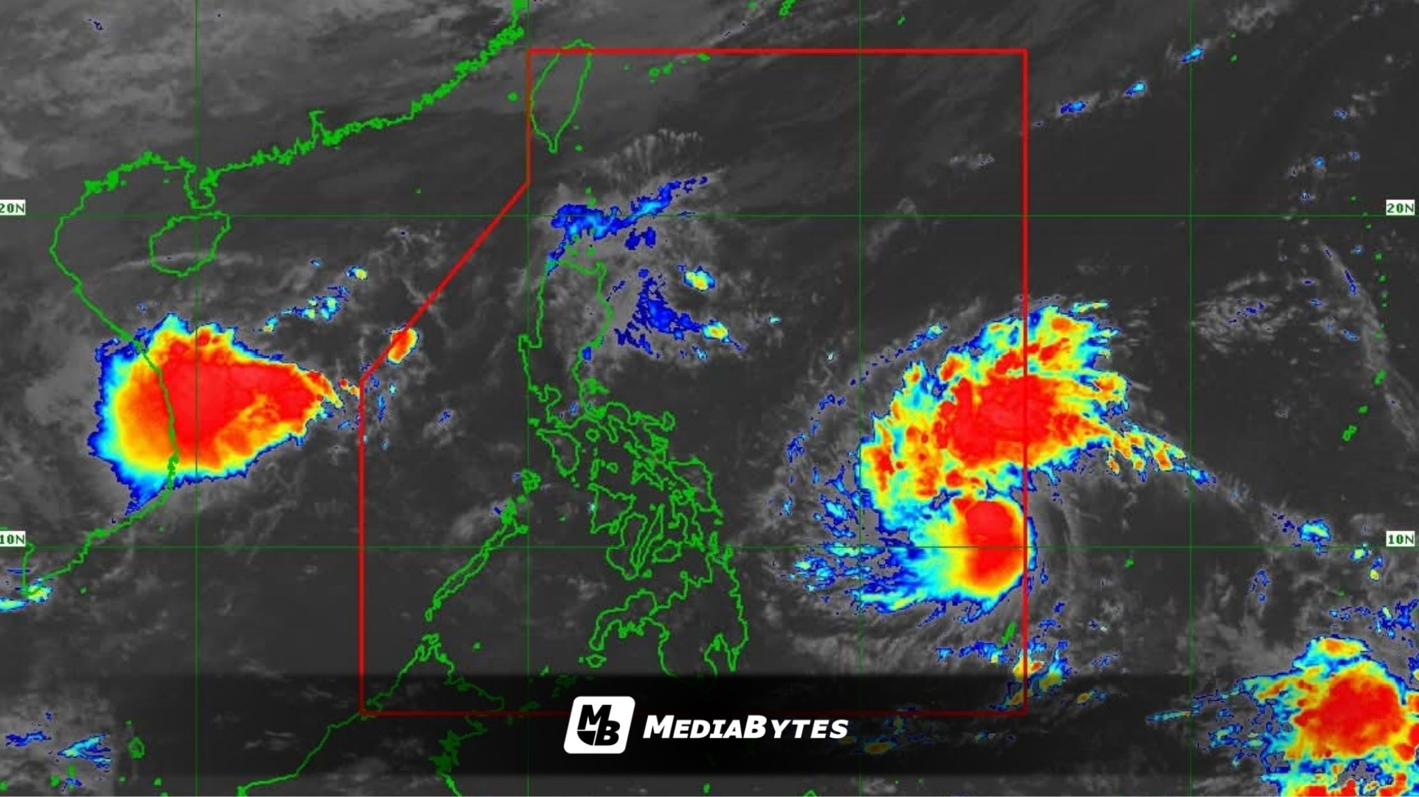
Tropical Storm Tino has officially entered the Philippine Area of Responsibility (PAR), becoming the country’s 20th tropical cyclone of the year, the Philippine Atmospheric, Geophysical and Astronomical Services Administration (PAGASA) announced on Saturday.
In its 11 a.m. bulletin, PAGASA said Tino was spotted 955 kilometers east of Eastern Visayas, moving westward at 30 kilometers per hour (kph) with maximum sustained winds of 85 kph near the center and gustiness of up to 105 kph.


Tropical Cyclone Wind Signal (TCWS) No. 1 has been raised over Eastern Samar, Dinagat Islands, and Surigao and Bucas Grande Islands, where minimal to minor impacts from strong winds are expected.
PAGASA added that the northeast monsoon (amihan), coinciding with Tino’s passage, will bring strong to gale-force winds across Batanes, Babuyan Islands, Ilocos Norte, northern and eastern Cagayan, eastern Isabela, Aurora, Quezon, Lubang Islands, Marinduque, Calaguas Islands, and Caluya Islands starting Sunday.
The weather bureau said Tino will continue moving westward over the next three days and is expected to make landfall over Eastern Samar or Dinagat Islands by Monday night or early Tuesday morning.
“Afterwards, Tino will traverse Visayas and northern Palawan before emerging over the West Philippine Sea on Wednesday morning or afternoon,” PAGASA said.
The agency also warned that Tino is likely to intensify into a typhoon within 24 hours and may even reach the super typhoon category under certain conditions.
“The possibility of reaching super typhoon category is not ruled out based on alternate scenarios and climatological data. While the passage over the country will trigger a slight weakening, Tino is expected to remain as a typhoon throughout its passage over the country,” PAGASA added.
A gale warning may be issued for the eastern seaboards of Eastern Visayas and Caraga Region by Sunday night or Monday morning, as very rough to perilous sea conditions are anticipated.
Authorities advised residents and disaster risk reduction offices to stay alert and take precautionary measures against potential flooding, landslides, and strong winds.
“Persons living in areas identified to be highly or very highly susceptible to these hazards are advised to follow evacuation and other instructions from local officials,” PAGASA said.
As the storm continues to move closer to the country, PAGASA is urging the public to remain vigilant and stay tuned to official weather updates for further advisories.