

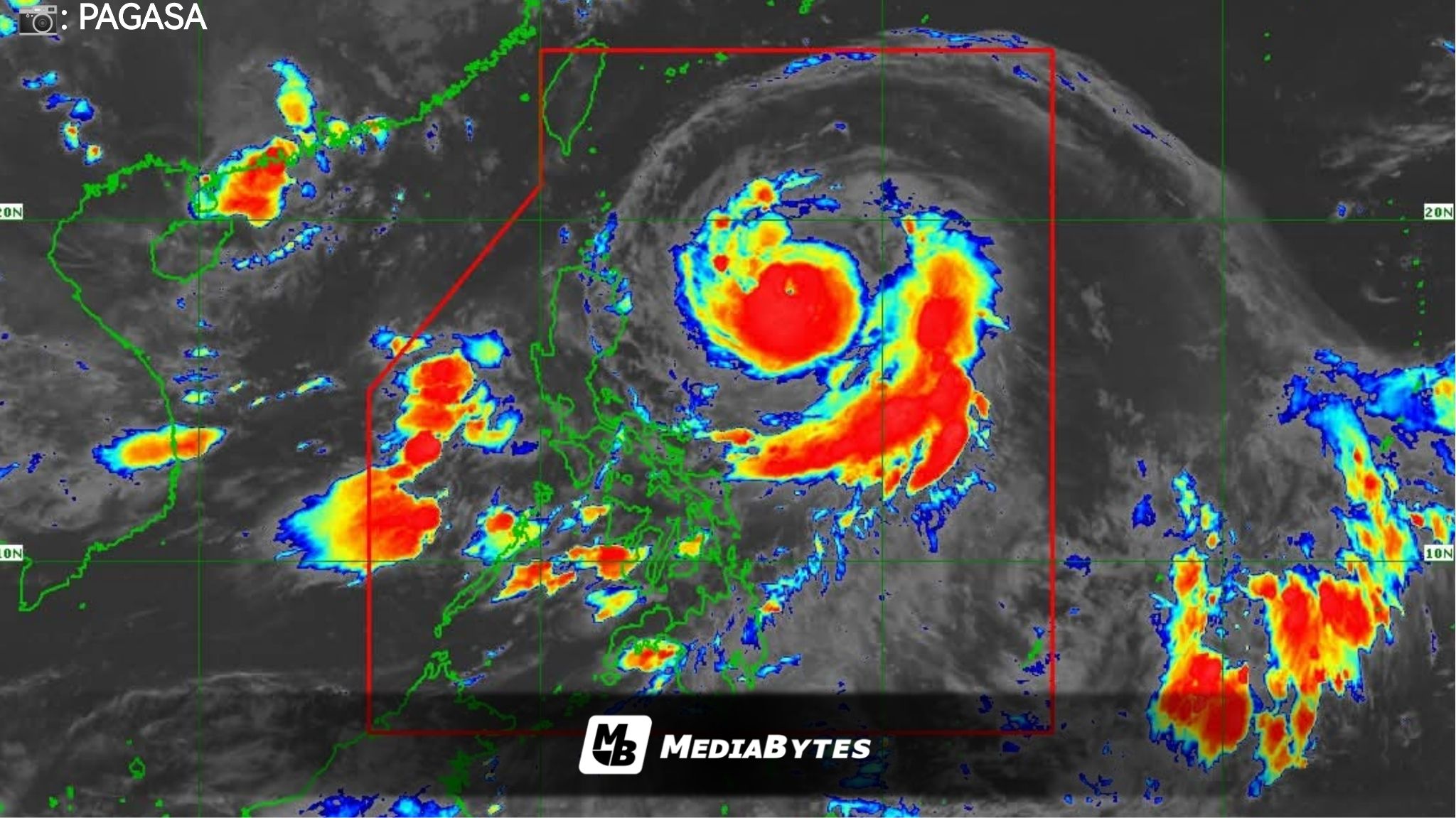
Typhoon Nando is gaining strength at a fast pace and is projected to become a super typhoon by Sunday evening, according to the latest advisory from the Philippine Atmospheric, Geophysical and Astronomical Services Administration (PAGASA).
As of 5AM Saturday, Nando’s center was spotted 610 kilometers east of Tuguegarao City, Cagayan. It currently packs maximum sustained winds of 175 kilometers per hour (kph) and gusts reaching 215 kph.


PAGASA weather specialist Obet Badrina cautioned residents in Northern Luzon to make early preparations, stressing that the storm “will continue to intensify before it approaches extreme Northern Luzon.”
Areas Under Wind Signals
- Signal No. 2: Batanes, Cagayan including Babuyan Islands, northeast Isabela, parts of Apayao and Kalinga
- Signal No. 1: Remaining parts of Isabela, Quirino, Nueva Vizcaya, Abra, Mountain Province, Ifugao, Benguet, Ilocos Region, La Union, Pangasinan, northern Zambales, much of Nueva Ecija and Tarlac, Aurora, and northern and central Catanduanes
PAGASA added that the highest wind signal that could be raised during Nando’s passage is Signal No. 5.
The habagat (southwest monsoon), enhanced by Nando, will continue to bring strong winds and rains over Metro Manila, Central Luzon, Calabarzon, Bicol, Mimaropa, Visayas, and parts of Mindanao.
Mariners of small boats and motorbancas were strongly advised not to sail due to dangerous sea conditions. Coastal communities in Batanes, Cagayan including Babuyan Islands, Ilocos Norte, and Ilocos Sur also face the risk of life-threatening storm surges up to 3 meters within the next 48 hours.
Meanwhile, outside the Philippine Area of Responsibility (PAR), Tropical Cyclone Neoguri has already intensified into a super typhoon. As of 3AM, it was located 3,295 kilometers east-northeast of extreme Northern Luzon, packing maximum sustained winds of 185 kph and gusts of 230 kph while moving west-northwest at 25 kph.