

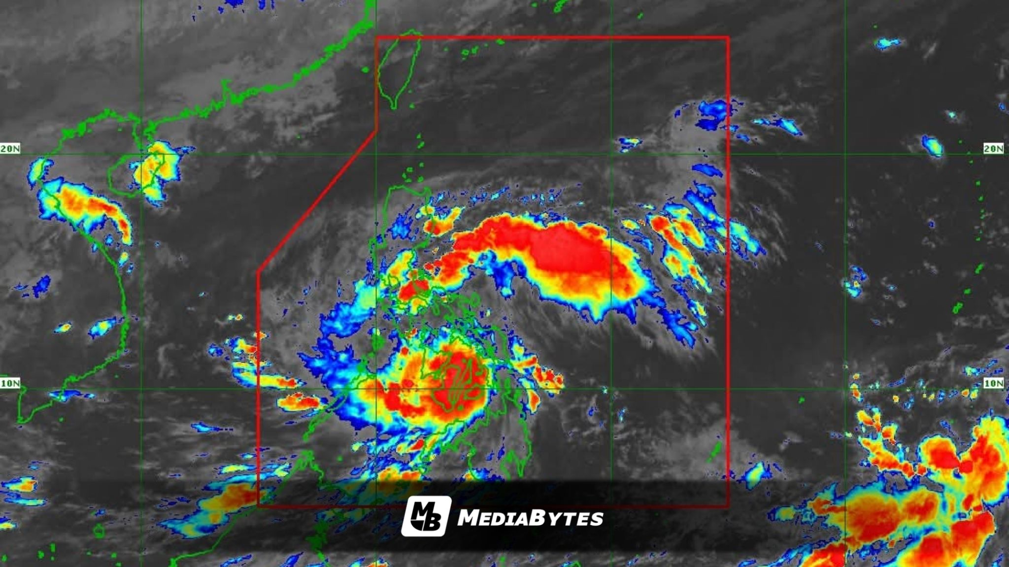
Typhoon Tino continues to lash parts of the Visayas with destructive winds and torrential rains as it tracks west northwestward toward Negros Island Region, the Philippine Atmospheric, Geophysical and Astronomical Services Administration (PAGASA) reported Tuesday morning.


“Nakapagtala tayo ng pangalawang landfall niya kaninang 5:10 a.m. dito sa may Borbon, Cebu,” said weather specialist Chenel Dominguez in a 5:45 a.m. briefing.
Dominguez added: “Patuloy pong nagta-traverse ng ating kalupaan dito sa may Negros Island Region pati na rin dito sa may Western Visayas.”
As of 8 a.m., Tino’s eye was spotted over the vicinity of Sagay City, Negros Occidental, packing maximum sustained winds of 150 km/h and gusts reaching up to 205 km/h, while moving west northwestward at 25 km/h. Strong winds extend outward up to 300 km from the center.
Tino made its first landfall in Silago, Southern Leyte around midnight Tuesday.
Multiple provinces in the Visayas and parts of Luzon and Mindanao are now under Tropical Cyclone Wind Signals (TCWS) Nos. 1 to 4, including Leyte, Cebu, Bohol, Negros, Iloilo, Antique, and Palawan.
PAGASA warned of possible flash floods and landslides in Palawan, Western Visayas, the Negros Island Region, and Central Visayas due to heavy to intense rains.
Other regions such as Eastern Visayas, Northern Mindanao, Albay, Masbate, and parts of Mimaropa will also experience gusty winds and scattered rain showers from Tino’s outer bands.
Metro Manila and nearby regions may have cloudy skies with scattered rains and isolated thunderstorms due to the shear line, while the northeast monsoon (amihan) will bring rains over Northern Luzon.
PAGASA said Tino is expected to cross Visayas and northern Palawan before emerging over the West Philippine Sea by Wednesday morning and may exit the Philippine Area of Responsibility (PAR) by Wednesday night or Thursday morning.
“Due to interaction with the terrain, Tino may slightly weaken while crossing Visayas. However, Tino is expected to remain at typhoon category throughout its passage over the country,” PAGASA said.
Meanwhile, a low-pressure area (LPA) outside PAR, located 2,165 km east of northeastern Mindanao, is being monitored and has a high chance of developing into a tropical depression within 24 hours.