

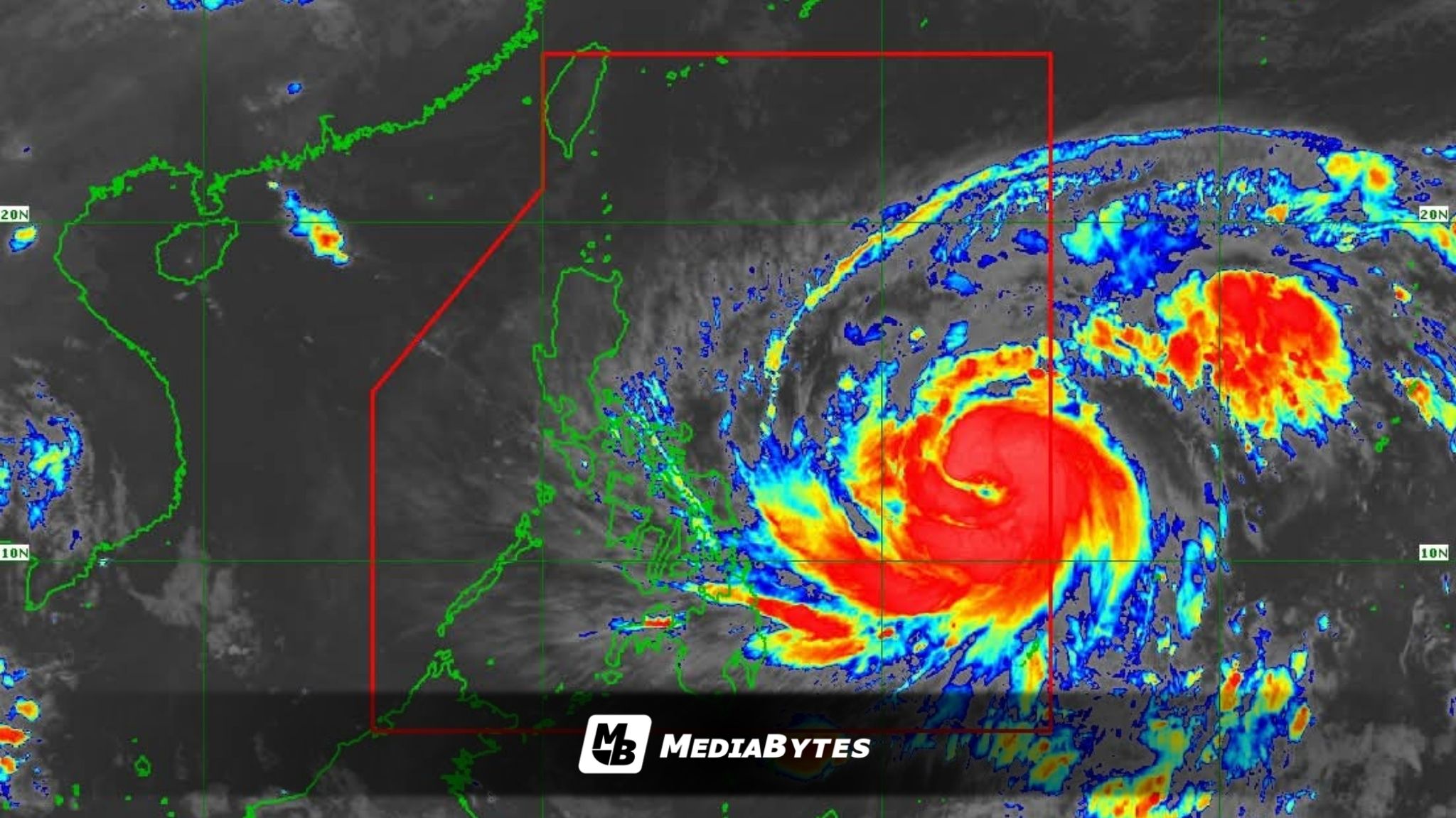
Typhoon Uwan has intensified further as it continues to move closer to Eastern Visayas, the state weather bureau reported early Saturday.
In its 5 a.m. bulletin, the Philippine Atmospheric, Geophysical and Astronomical Services Administration (PAGASA) said the typhoon’s center was located 985 kilometers east of Eastern Visayas, moving west-northwest at 25 km/h. It now packs maximum sustained winds of 130 km/h near the center and gustiness of up to 160 km/h.


Tropical Cyclone Wind Signal (TCWS) No. 2 is currently raised over Catanduanes, as well as portions of Northern Samar, Eastern Samar, and Samar, where stormy conditions are expected. Meanwhile, Signal No. 1 has been hoisted over large parts of Luzon, Visayas, and Mindanao, including Metro Manila, Isabela, Aurora, Cebu, Negros Occidental, Aklan, Antique, Capiz, Dinagat Islands, and Surigao del Norte.

PAGASA said Uwan is projected to move west-northwestward until Monday, possibly making landfall over the southern portion of Isabela or the northern part of Aurora late Sunday or early Monday. It will then cross Northern Luzon’s mountainous areas before emerging over the West Philippine Sea by Monday afternoon.

The weather bureau added that Uwan may rapidly intensify into a super typhoon by late Saturday or early Sunday and could hit land at or near its peak strength. While some weakening is expected after landfall due to terrain interaction, it will likely remain a typhoon throughout its passage.
Heavy to intense rains may bring flash floods and landslides over Catanduanes, Northern Samar, and Eastern Samar, while moderate to strong winds and rough seas are expected across much of the country. Residents in high-risk areas are urged to stay alert and follow local evacuation advisories.