

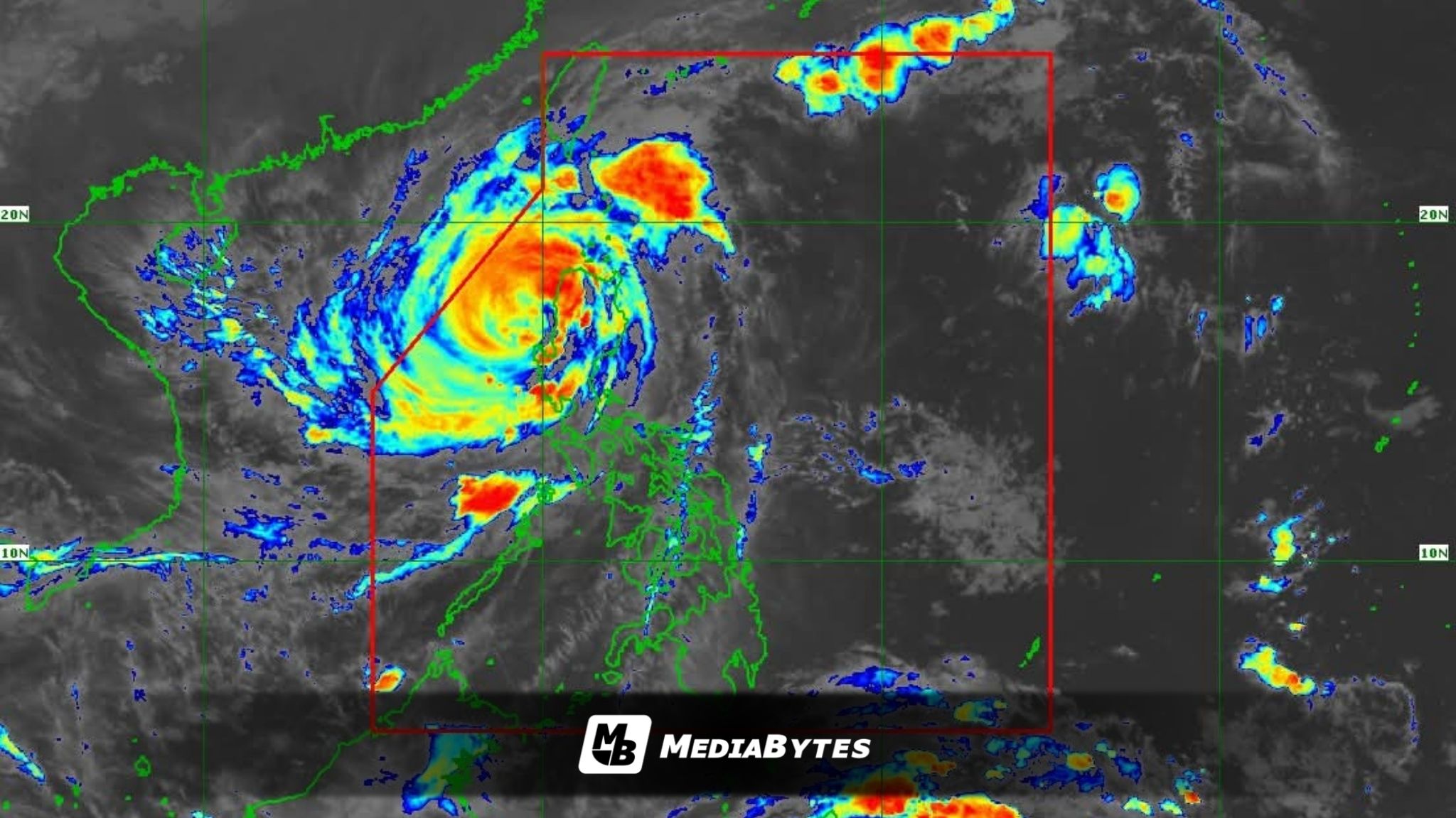
Typhoon Uwan weakened further early Monday morning as it moved over the coastal waters of Bacnotan, La Union, according to the Philippine Atmospheric, Geophysical and Astronomical Services Administration (PAGASA).
In its 5 a.m. advisory, PAGASA said the typhoon’s center was spotted over Bacnotan’s coastal waters, carrying maximum sustained winds of 150 km/h near the center and gustiness of up to 230 km/h, while moving west-northwest at 25 km/h.


Strong to typhoon-force winds extend up to 780 kilometers from its center.
Signal No. 4 remains raised over parts of Nueva Vizcaya, Kalinga, Mountain Province, Abra, Ifugao, Benguet, Ilocos Sur, La Union, Pangasinan, Nueva Ecija, Tarlac, and Zambales, where typhoon-force winds of 118 to 184 km/h are expected within 12 hours, posing severe threats to life and property.

Signal No. 3 is still up in portions of Cagayan, Isabela, Apayao, Kalinga, Abra, Mountain Province, Quirino, Ilocos Norte, Ilocos Sur, Nueva Vizcaya, Nueva Ecija, Aurora, Bulacan, Pampanga, Tarlac, Zambales, and Bataan, while lower signals remain in effect across other parts of Luzon and the Visayas.
PAGASA warned that heavy to intense rainfall may trigger flooding and rain-induced landslides, especially in high-risk areas of Northern and Central Luzon.
Severe structural damage and power outages are expected in Signal No. 4 areas, while storm-force and gale-force winds will bring moderate to significant impacts elsewhere.
A gale warning remains over the seaboards of Luzon and the western coast of Western Visayas, with waves reaching up to 12 meters high in La Union and northern Pangasinan — extremely hazardous to all marine vessels.
Life-threatening storm surges exceeding 3 meters are also possible along coastal communities in the Ilocos Region, Cagayan Valley, Central Luzon, Metro Manila, Calabarzon, Mimaropa, Bicol Region, and parts of Western Visayas.
PAGASA said Uwan will continue to move west-northwest over the next 12 hours before turning northwest to north over the West Philippine Sea, where it may re-intensify by Tuesday and Wednesday.

By midweek, the system is expected to curve northeastward toward the Taiwan Strait and weaken again before making landfall in western Taiwan on Thursday.