

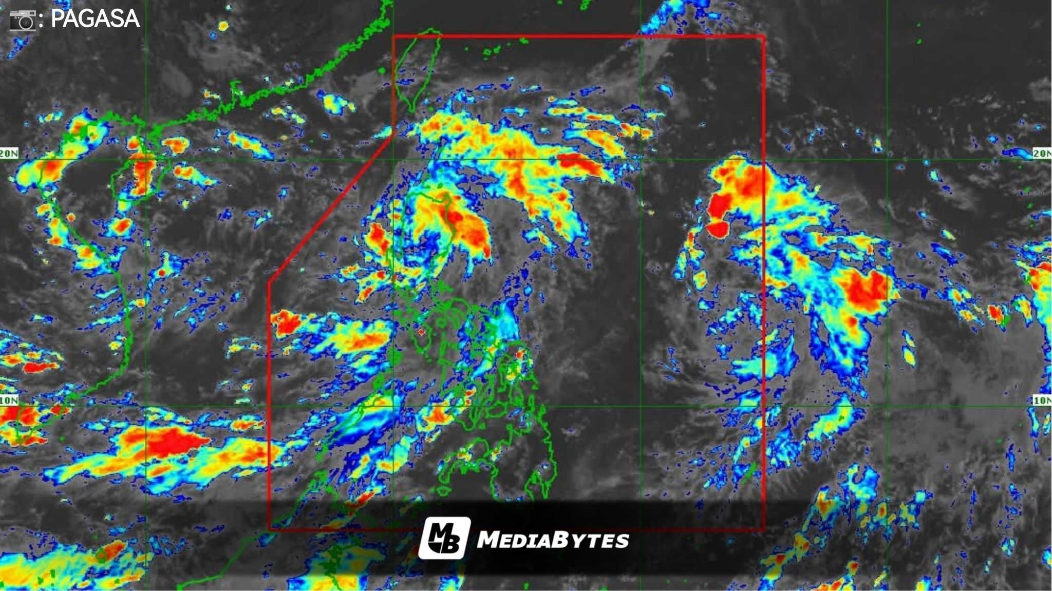
Tropical Depression (TD) Mirasol continues to cross Northern Luzon, with Tropical Cyclone Wind Signal (TCWS) No. 1 still raised in several provinces, the Philippine Atmospheric, Geophysical and Astronomical Services Administration (PAGASA) said Wednesday.

As of 10AM, Mirasol was located in the vicinity of Alfonso Lista, Ifugao, packing maximum sustained winds of 55 kilometers per hour (kph) near the center and gusts of up to 90 kph.

Strong winds are expected in areas under TCWS No. 1: Batanes, Cagayan including Babuyan Islands, Isabela, Quirino, Nueva Vizcaya, northern and central Aurora (Dilasag, Casiguran, Dinalungan, Dipaculao, Baler, Maria Aurora), Apayao, Abra, Kalinga, Mountain Province, Ifugao, Benguet, Ilocos Norte, Ilocos Sur, La Union, northeastern Pangasinan (San Nicolas, Natividad, San Manuel, Sison, San Quintin, Tayug), and northern Nueva Ecija (Carranglan, Pantabangan).
The southwest monsoon will also bring strong to gale-force gusts across the southern portion of Quezon, Camarines Norte, Camarines Sur, Mimaropa, Western Visayas, and Negros Occidental.
PAGASA warned that Mirasol will continue to dump heavy rains in Aurora, Cagayan, Isabela, Quirino, La Union, Ifugao, Mountain Province, Kalinga, Apayao, Abra, Benguet, Ilocos Norte, Ilocos Sur, and Nueva Ecija.
The tropical depression is forecast to exit the Philippine Area of Responsibility (PAR) by Thursday.
Meanwhile, PAGASA is also tracking another tropical depression outside PAR, located 1,265 km east of Southern Luzon as of 10 a.m.
This weather disturbance could enter PAR late Wednesday or Thursday and will be named Nando.
“TD Nando is less likely to directly affect the weather and sea condition in the next 48 hours,” PAGASA said.