


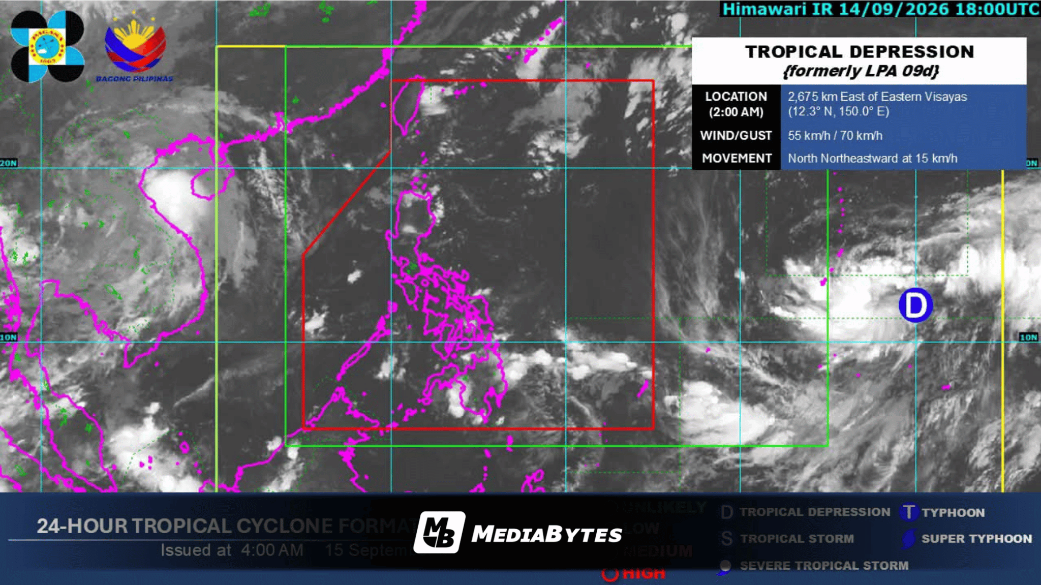
State weather bureau PAGASA is monitoring a tropical depression outside the Philippine Area of Responsibility (PAR) while easterlies continue to affect Extreme Northern Luzon on Tuesday, September 15.
As of 3:00 AM, the weather disturbance was spotted 2,675 kilometers east of Eastern Visayas (12.4°N, 150.0°E). It carries maximum sustained winds of 55 kilometers per hour near the center and gusts of up to 70 kph, moving north-northeastward at a speed of 15 kph.
Due to the prevailing easterlies, Batanes and the Babuyan Islands will experience partly cloudy to cloudy skies accompanied by isolated rain showers or thunderstorms.
Metro Manila and the remainder of the country will likewise face partly cloudy to cloudy weather with localized thunderstorms bringing brief rain showers.
PAGASA confirmed that it will keep tracking the tropical depression while it stays beyond the country’s weather monitoring zone.