


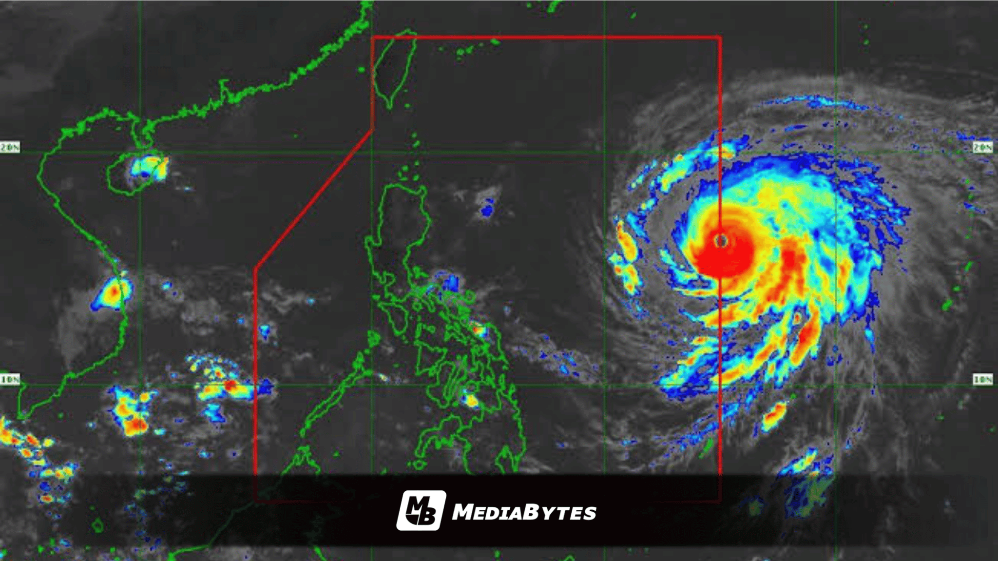
MANILA — The Office of Civil Defense (OCD) has directed regional and local disaster risk reduction and management councils to ramp up preparedness, preposition essential supplies, and deploy personnel following the entry of Super Typhoon Rosal into the Philippine Area of Responsibility (PAR) on Tuesday, October 20.
OCD Spokesperson Director Junie Castillo announced that instructions have already been dispatched to local disaster councils and National Disaster Risk Reduction and Management Council (NDRRMC) member agencies to execute scenario-building exercises, evaluate potential hazards, and distribute food, gear, and resources to vulnerable zones.
“We have already issued directives to our regional and local DRRMCs and disaster councils to undertake preparedness measures. Included in that directive is the conduct of their respective disaster risk assessments or scenario building. This is where we determine where, when, and how severe the rainfall, typhoon, flooding, or other hazards may affect different areas,” Castillo stated.
The directive follows a Pre-Disaster Risk Assessment (PDRA) coordinated by the OCD and NDRRMC, referencing the latest weather trajectories from the Philippine Atmospheric, Geophysical and Astronomical Services Administration (PAGASA).
“So in our preparations, this includes the prepositioning of food, personnel, equipment, and various resources needed for response operations,” Castillo added.
To tighten tracking and coordination efforts, the NDRRM Operations Center (NDRRMOC) has elevated its alert level to “Blue”. Under this protocol, uniformed disaster response personnel are required to report physically to the operations center as detailed duty officers, while other agency representatives participate virtually on standby for rapid augmentation.
If conditions warrant a “Red” alert, all Response Cluster agencies must deploy their personnel on-site.
According to PAGASA, Super Typhoon Rosal—internationally named Champi—was spotted 1,385 kilometers east of Central Luzon, packing peak sustained winds of 185 kilometers per hour alongside gusts reaching 230 kilometers per hour while tracking west-northwestward at 25 kilometers per hour.
Although a direct landfall is not anticipated, meteorological agencies cautioned that its expansive outer circulation could generate hazardous weather conditions well beyond its main path. Tropical Cyclone Wind Signal No. 1 has been hoisted over parts of Batanes, the Cagayan Valley, and Catanduanes. Weather authorities noted that the peak wind signal anticipated during the storm’s progression has been revised to Signal No. 2 or No. 3.
Castillo stressed that disaster managers are keeping a close eye on Northern Luzon and the eastern seaboard while continuously restocking reserves.
“What we are doing, whether there is a typhoon or not, is continuously replenishing food and non-food supplies whenever stocks are reduced. We are monitoring the prepositioning in Extreme Northern Luzon. This is a large typhoon, so we are not only watching Extreme Northern Luzon but also Central Luzon, the National Capital Region and the eastern seaboard of Luzon,” he explained.