


MANILA, Philippines — The Philippine Atmospheric, Geophysical and Astronomical Services Administration (PAGASA) reported that the Northeast Monsoon is bringing cloudy skies and light rains to Northern Luzon, while the easterlies continue to influence weather conditions across the rest of the country.
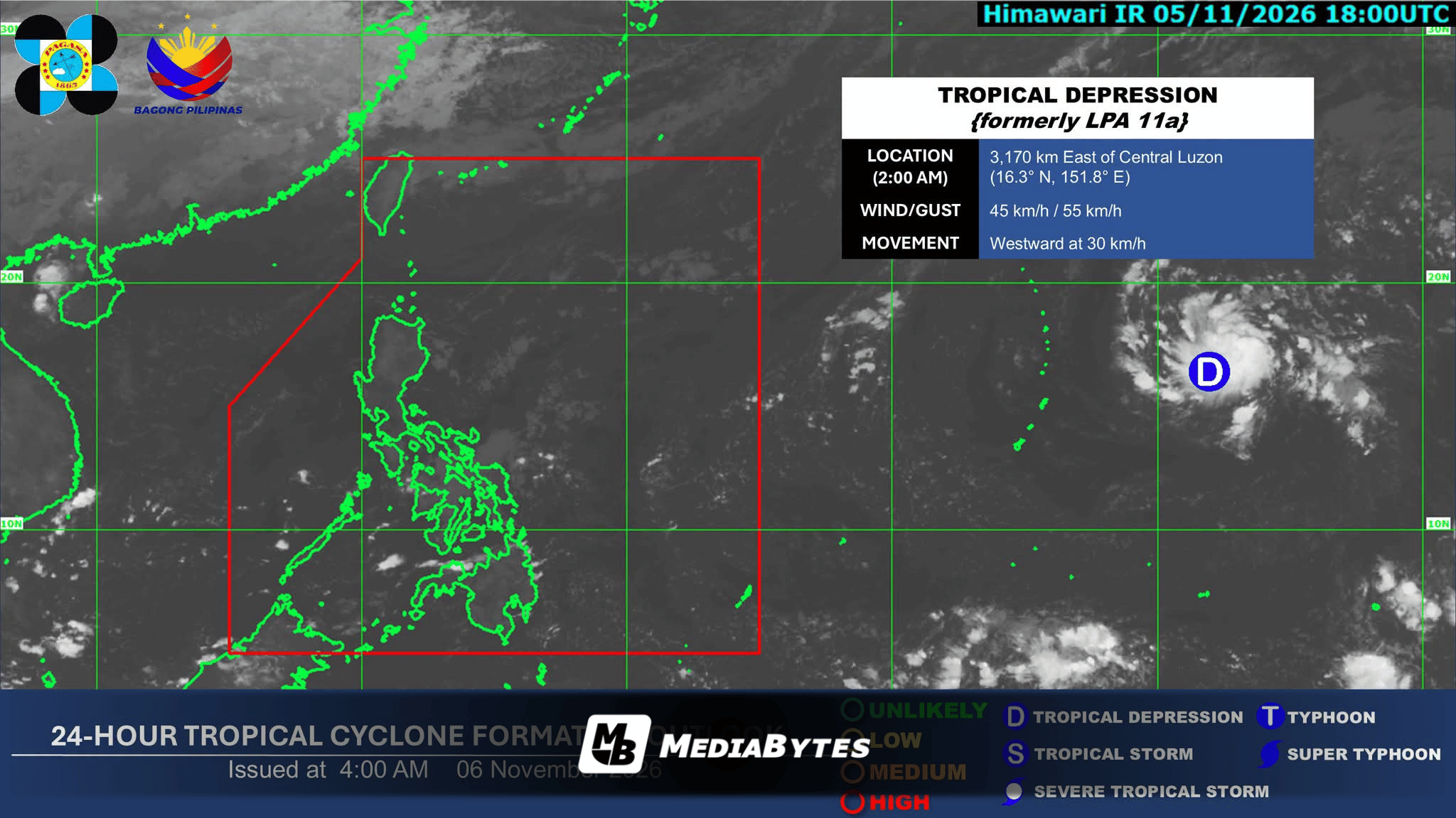
Concurrently, weather bureau monitoring identified that a low-pressure area previously tracked outside the Philippine Area of Responsibility (PAR) intensified into a tropical depression by 2:00 a.m.
The system was spotted 3,145 kilometers east of Central Luzon, packing maximum sustained winds of 45 kilometers per hour near the center, gustiness of up to 55 km/h, and moving westward at a speed of 30 km/h.
Regional Weather Outlook
- Eastern Visayas, Caraga, and Davao Oriental: Expected to experience cloudy skies with scattered rains and thunderstorms driven by the easterlies, with warnings for potential flash floods or landslides during moderate to heavy downpours.
- Ilocos Region, Cordillera Administrative Region, and Cagayan Valley: Will see partly cloudy to cloudy skies with isolated light rains due to the northeast monsoon, expected to bring no significant impact.
- Metro Manila and the Rest of the Country: To have partly cloudy to cloudy conditions accompanied by isolated rain showers or thunderstorms caused by the easterlies, alongside risks of flash floods or landslides during severe convective activity.
Wind and Coastal Conditions
Extreme Northern Luzon will experience moderate winds moving from the northeast to east, resulting in moderate coastal waters.
The rest of Luzon, as well as the Visayas and Mindanao regions, can anticipate light to moderate wind speeds moving in a general northeast to east direction, accompanied by slight to moderate coastal water conditions.