


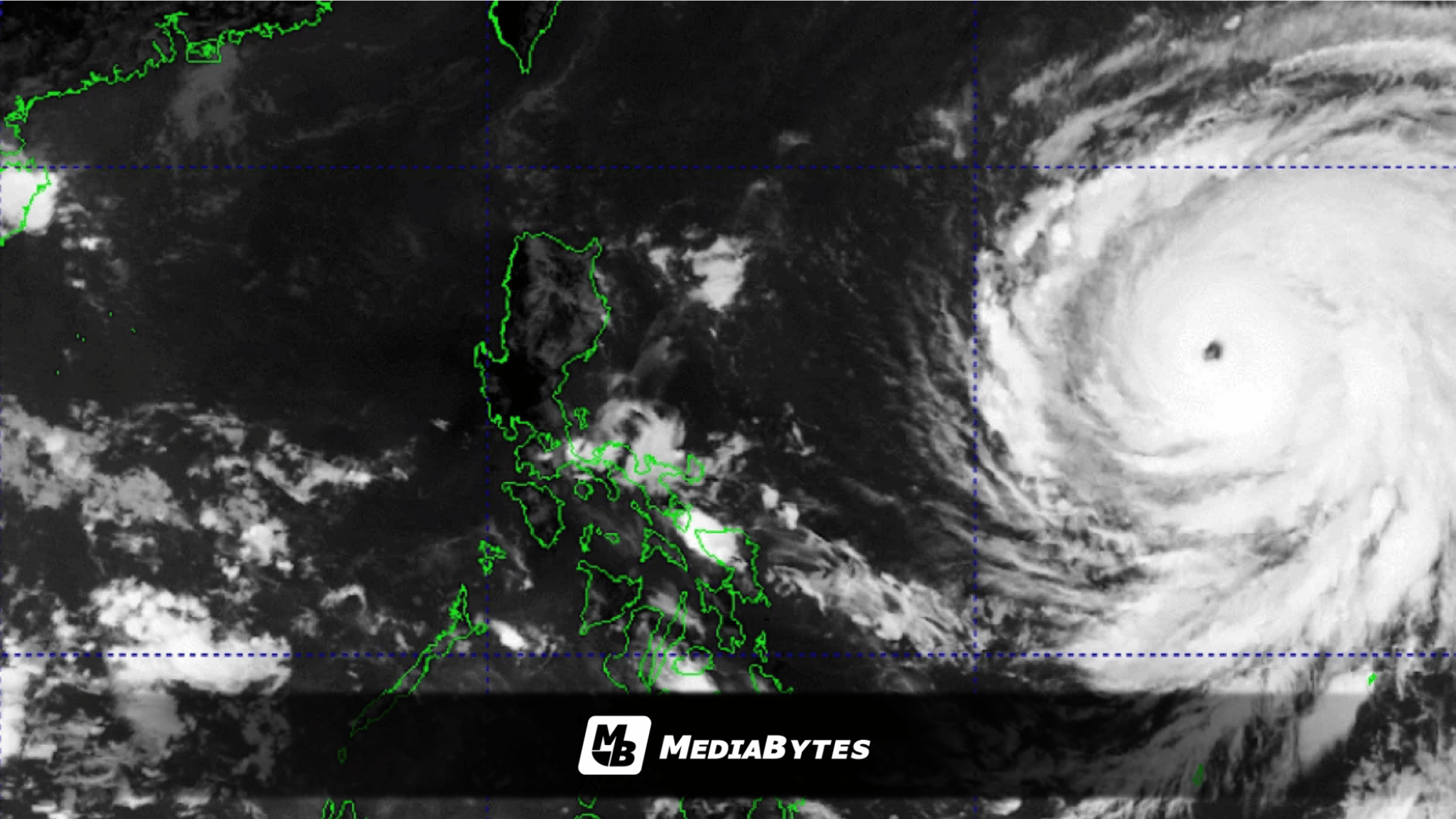
QUEZON CITY — State weather bureau PAGASA hoisted Tropical Cyclone Wind Signal No. 1 over several areas in northeastern Luzon after Super Typhoon Rosal (international name: Champi) entered the Philippine Area of Responsibility (PAR) on Tuesday, October 20.
According to PAGASA’s 11 a.m. bulletin on Tuesday, Rosal was spotted 1,385 kilometers east of Central Luzon, packing maximum sustained winds of 185 kph near the center and gusts of up to 230 kph while moving west-northwestward at 25 kph.
Signal No. 1 is currently raised over Batanes, the eastern portion of the Babuyan Islands, the eastern part of mainland Cagayan, the northeastern section of Isabela, and the northeastern portion of Catanduanes.
While the super typhoon is not projected to make landfall, forecasters warn that its broad circulation will still bring severe weather, with maximum wind signals potentially peaking at Signal No. 2 or 3.
“It must be emphasized that heavy rainfall and severe winds may still be experienced in localities outside the landfall point and the forecast confidence cone,” PAGASA stated, noting that the storm’s track could still shift within forecast limits.
PAGASA Administrator Nathaniel Servando highlighted during a press briefing that Batanes is expected to bear the brunt of the weather disturbance and urged residents to remain vigilant against potential floods, landslides, and rough seas.
“Bagamat nakararanas tayo ng malakas na El Niño, mahalagang tandaan natin na hindi tayo ligtas sa banta ng mga tropical cyclone,” Servando said.
He also advised the public, particularly in high-risk areas, to suspend sea travel and heed local government directives.
“Kaya naman pinapayuhan natin ang ating mga kababayan lalo na sa Batanes area na maging mapagmatyag at magsagawa ng kinakailangang paghahanda. Dahil ang super typhoon na si Rosal ay may dalang panganib. Siguraduhin natin ligtas ang ating mga tahanan, iwasan ang paglalayag kung mapanganib ang kondisyon ng dagat.”
Servando added that continuous monitoring is vital as conditions change.
“Maaaring magbago ang lakas, direksyon at epekto ng bagyo kaya mahalagang updated tayo sa pinakabagong information upang makapaghanda tayo nang maaga at makagawa ng tamang desisyon.”
Rosal is expected to maintain a west-northwestward path through Wednesday before shifting north by Friday, with an anticipated exit from the PAR by late Friday or early Saturday.