


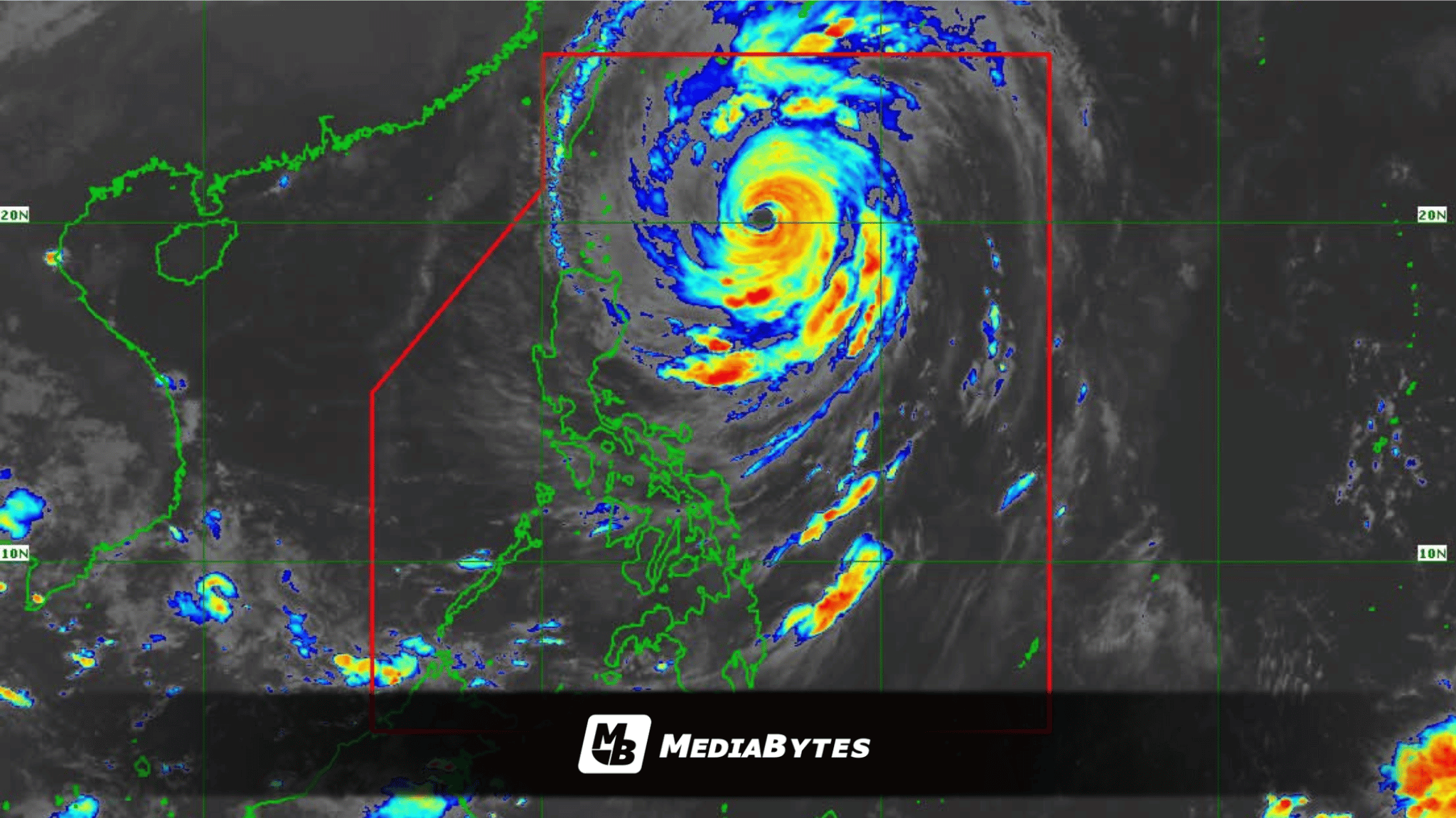
MANILA, Philippines — Super Typhoon Rosal experienced a slight reduction in intensity early Thursday morning while tracking northwestward over the Philippine Sea, according to an early morning advisory released by the Philippine Atmospheric, Geophysical and Astronomical Services Administration (PAGASA).
Based on the bureau’s 5 a.m. bulletin, Rosal was tracked at 4 a.m. packing maximum sustained winds of 195 kilometers per hour close to the center with gustiness reaching up to 240 kilometers per hour, down from 1.95 lakh—corrections aside, down from 205 kilometers per hour recorded six hours prior.
The center of the weather disturbance was pinpointed at 495 kilometers east of Basco, Batanes, moving toward the northwest direction at a speed of 20 kilometers per hour.
In response to the looming threat, state meteorologists hoisted Tropical Cyclone Wind Signal No. 2 over Batanes and the northeastern section of the Babuyan Islands.
Meanwhile, Signal No. 1 has been placed over the remainder of the Babuyan Islands, mainland Cagayan, Ilocos Norte, Apayao, and eastern Isabela localities—including Maconacon, Divilacan, Palanan, Santa Maria, Cabagan, Delfin Albano, Santo Tomas, Tumauini, San Pablo, Ilagan City, San Mariano, and Dinapigue.
Hazardous weather conditions are anticipated as Batanes braces for stormy weather, while heavy rains accompanied by gusty winds sweep across Ilocos Norte, Apayao, Cagayan, and Isabela. The expansive outer bands and trough of the super typhoon will likewise trigger cloudy skies with scattered rain showers and thunderstorms over the Bicol Region, the remaining areas of the Cordillera Administrative Region and Cagayan Valley, Ilocos Sur, La Union, Aurora, Northern Samar, and Eastern Samar.
Additional inclement weather driven by the storm’s trough will affect the Zamboanga Peninsula, Western Visayas, the Negros Island Region, Lanao del Norte, Misamis Occidental, and Palawan, while Metro Manila and the rest of the country experience isolated localized thunderstorms.
Coastal waters will be moderate to rough along the eastern seaboards of Central Luzon, Southern Luzon, and the Visayas.
PAGASA reported that Rosal is projected to execute its closest approach to Extreme Northern Luzon within the window of Thursday afternoon through Friday morning, before ultimately tracking out of the Philippine Area of Responsibility by Friday evening or early Saturday.
Forecasters anticipate a gradual weakening trend that could downgrade Rosal into a typhoon later today, followed by a rapid degradation into a severe tropical storm by Saturday.