


QUEZON CITY — Three active weather systems are currently influencing different parts of the country, bringing varied conditions ranging from isolated showers to thunderstorms, according to the Philippine Atmospheric, Geophysical and Astronomical Services Administration (PAGASA).
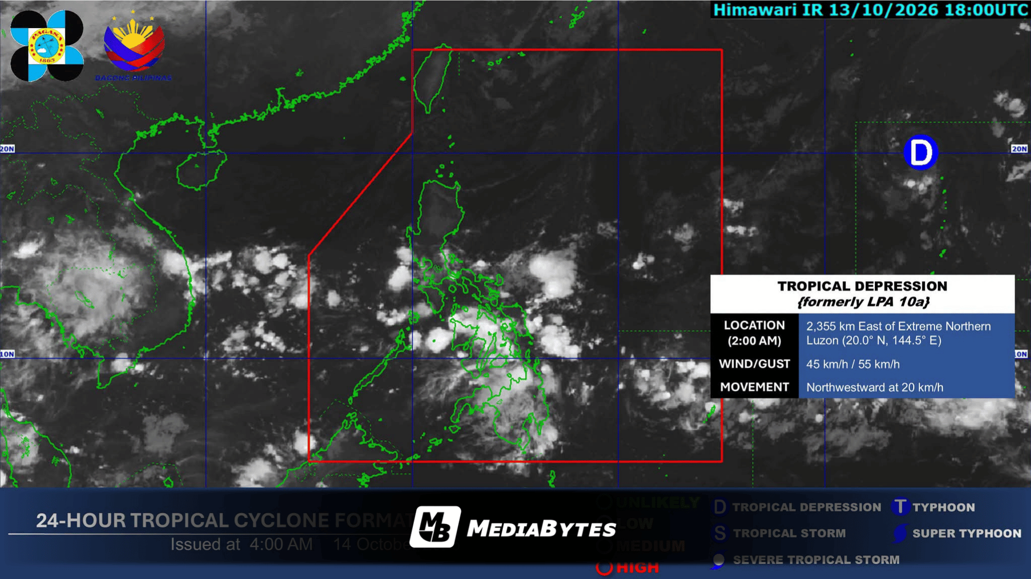
State weather bureau PAGASA announced that it is also keeping a close eye on a tropical depression currently located outside the Philippine Area of Responsibility (PAR).
As of the latest tracking, the cyclone was spotted 2,340 kilometers east of extreme Northern Luzon, carrying maximum sustained winds of 45 kilometers per hour while moving northwestward at a speed of 20 kilometers per hour.
Meanwhile, localized weather patterns continue to impact domestic regions. The Intertropical Convergence Zone is bringing cloudy skies accompanied by scattered rains and thunderstorms to the Visayas and Mindanao.
In Northern Luzon, the Ilocos Region, Cordillera Administrative Region, and Cagayan Valley are experiencing partly cloudy to cloudy skies with isolated light rains due to the Northeasterly Windflow.
Metro Manila and the remaining parts of Luzon can expect similar skies punctuated by isolated rain showers or thunderstorms driven by localized convective activity.