


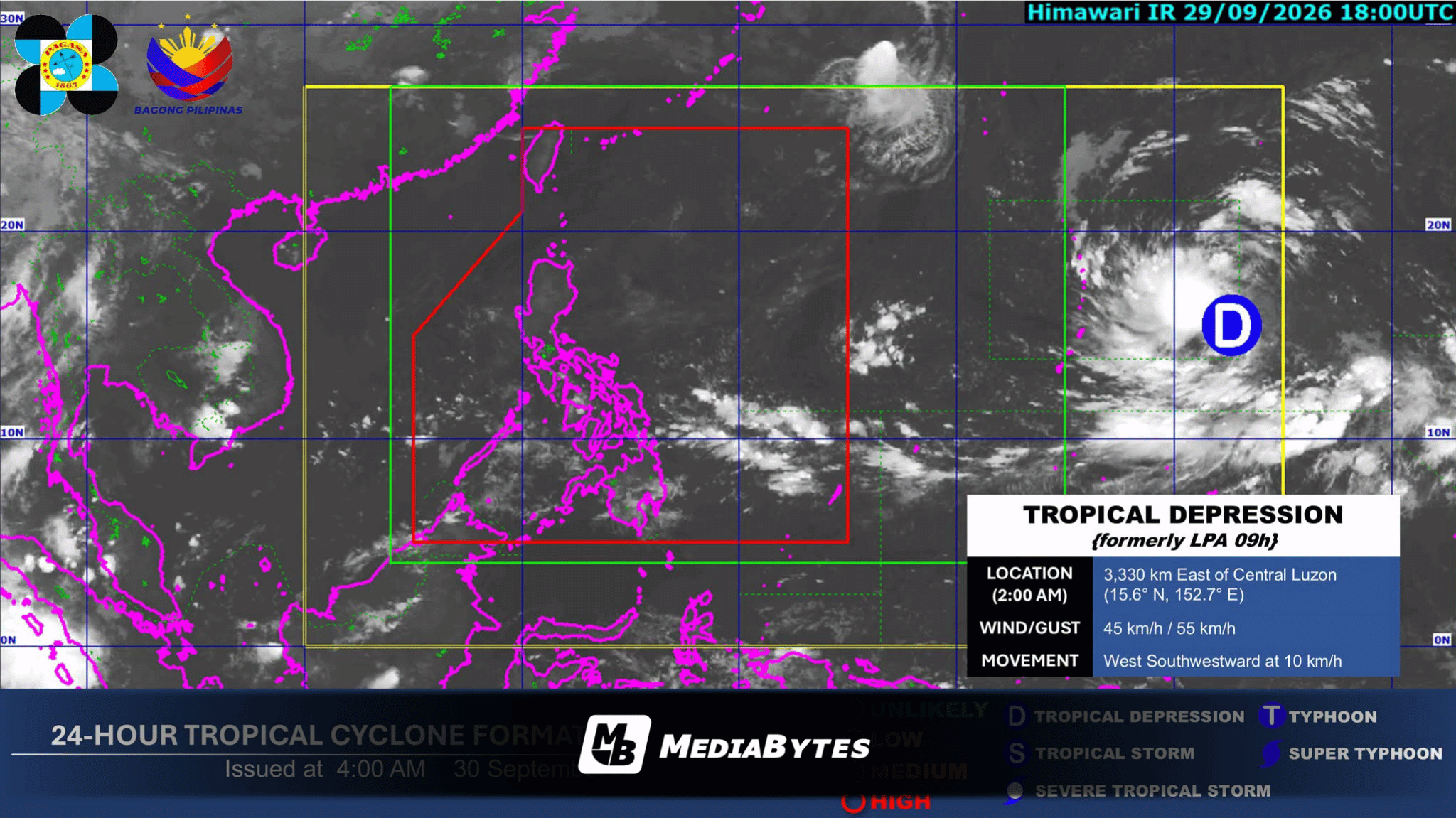
MANILA, Philippines — A low-pressure area outside the Philippine Area of Responsibility (PAR) has intensified into a tropical depression on Wednesday morning, according to the state weather bureau.
The Philippine Atmospheric, Geophysical and Astronomical Services Administration (PAGASA) reported that as of 3:00 a.m. on September 30, the weather disturbance was spotted 3,315 kilometers east of Central Luzon (15.6°N, 152.6°E).
The system is moving west-southwest at 10 kilometers per hour, carrying maximum sustained winds of 45 km/h near the center and gusts reaching up to 55 km/h. PAGASA confirmed the system has not yet entered the country’s monitoring region.
Simultaneously, the Intertropical Convergence Zone (ITCZ) is driving weather conditions across the southern and western regions of the country. Cloudy skies accompanied by scattered rain showers and thunderstorms are expected over the Negros Island Region, Zamboanga Peninsula, and Palawan.
Partly cloudy to overcast conditions with isolated rain showers or localized thunderstorms will prevail over Metro Manila and the remaining areas of Luzon, as well as the rest of the Visayas and Mindanao.
Weather authorities warned residents in vulnerable areas to stay vigilant against potential flash floods and landslides during heavy rain downpours.