

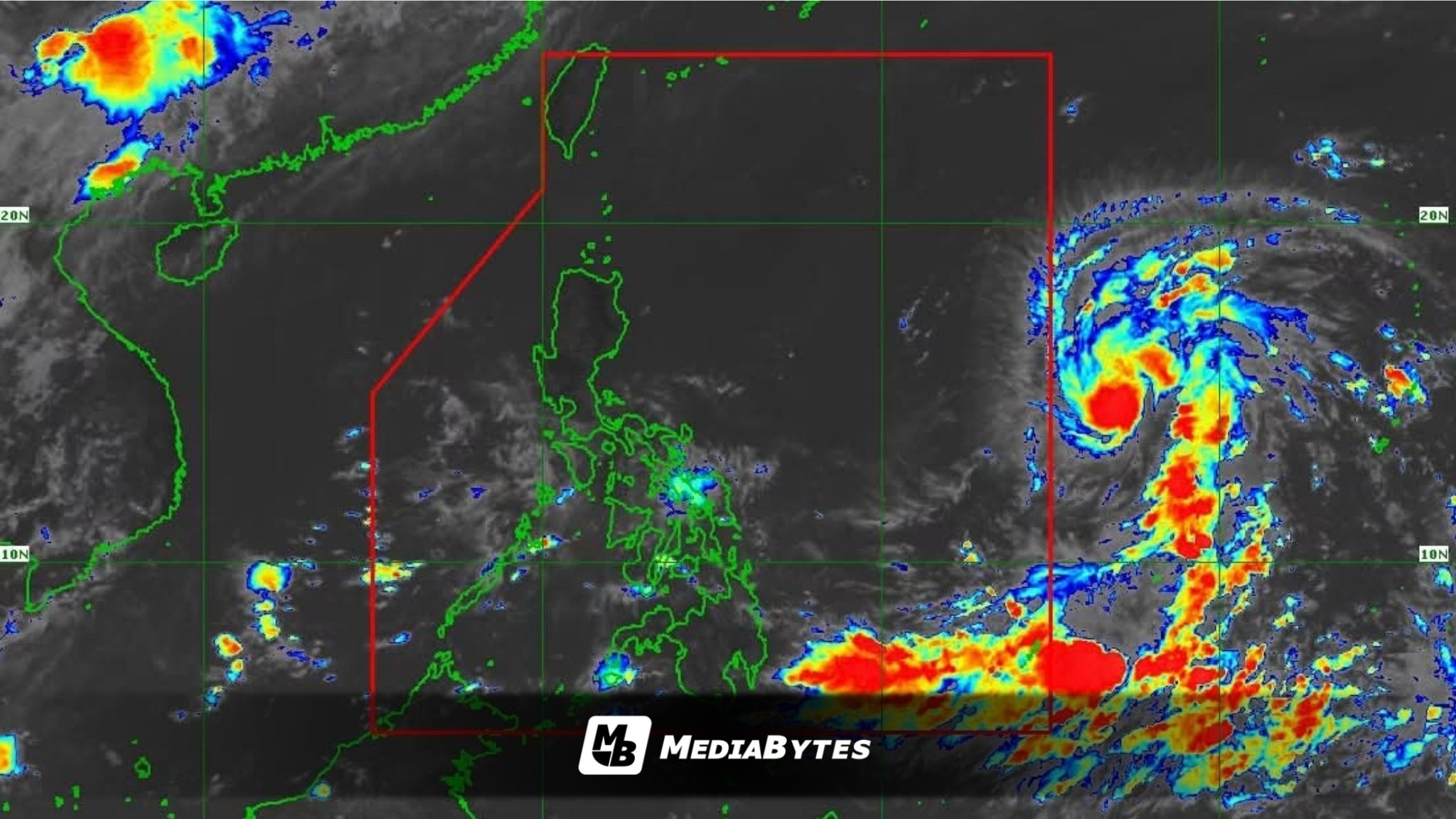
A weather disturbance monitoring east of the Visayas has intensified from a low-pressure area into a tropical storm and is projected to upgrade into a typhoon by Sunday, June 21, as it approaches the Philippine Area of Responsibility (PAR).
According to Tropical Cyclone Advisory No. 4 issued at 11 a.m. on Saturday by the Philippine Atmospheric, Geophysical and Astronomical Services Administration (PAGASA), the storm was spotted approximately 1,590 kilometers east of Southeastern Luzon, tracking westward at a speed of 25 kilometers per hour.
The weather system currently maintains maximum sustained winds of 85 kilometers per hour near its center, with wind gusts peaking at 105 kilometers per hour.
State meteorologists project that the storm will cross into the PAR between Saturday evening and Sunday morning. Upon entry, the weather bureau will officially assign it the local name “Francisco.”
PAGASA forecasters indicated that the tropical cyclone is likely to gain strength over the warm waters of the Philippine Sea, emphasizing the potential for it to achieve typhoon status by Sunday.
While current models show that landfall is less likely, the state weather bureau noted that the hoisting of Tropical Cyclone Wind Signal No. 1 remains possible over sections of Northern Luzon due to the system’s proximity to the landmass.
“A landfall scenario is less likely at this time,” PAGASA said in its advisory.
Although the cyclone is not projected to directly disrupt national weather or maritime conditions over the next three days, it could bolster the southwest monsoon (Habagat). This interaction is expected to bring monsoon rains across several parts of the country starting Sunday.
PAGASA urged the public and local disaster risk reduction and management councils to stay vigilant and regularly check for further updates as the tropical system progresses.