


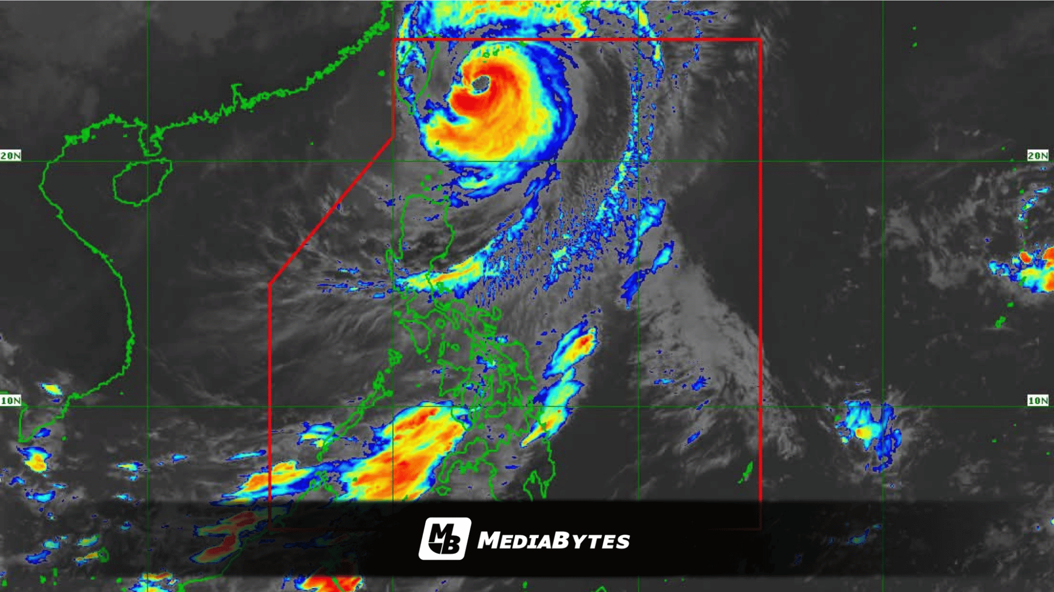
MANILA, Philippines — Typhoon Rosal is projected to leave the Philippine Area of Responsibility (PAR) by Saturday morning, October 24, as it tracks northwestward, according to the Philippine Atmospheric, Geophysical and Astronomical Services Administration (PAGASA).
As of 4 a.m. on Friday, October 23, the eye of Typhoon Rosal was detected 275 kilometers east-northeast of Itbayat, Batanes. It packs maximum sustained winds of 155 kilometers per hour near the center and gusts reaching up to 190 kph, moving northwestward at a speed of 15 kph.
PAGASA weather specialist Obet Badrina noted that the typhoon was set to make its closest approach to Batanes on Friday morning.
Wind Signals and Weather Impacts
Severe weather conditions continue to affect parts of Northern Luzon, prompting storm warnings:
- Tropical Cyclone Wind Signal No. 2: Raised over Batanes and the northeastern portion of the Babuyan Islands (Babuyan, Panuitan, Calayan, and Camiguin islands).
- Tropical Cyclone Wind Signal No. 1: In effect over the rest of the Babuyan Islands, mainland Cagayan, northeastern Isabela (Maconacon, Divilacan, Santa Maria, Cabagan, San Pablo, and Palanan), Ilocos Norte, and Apayao.
Badrina warned that stormy weather conditions are expected to persist over Batanes on Friday, while rainy and gusty weather will likely impact Ilocos Norte, Apayao, Cagayan, and Isabela.
Meanwhile, the remainder of the Cordillera Administrative Region, Cagayan Valley, Ilocos Sur, La Union, and Aurora can expect cloudy skies accompanied by scattered rain showers and thunderstorms.
Extended Weather Disturbances
The typhoon’s outer trough is also triggering scattered rains and thunderstorms across the Visayas, Zamboanga Peninsula, Masbate, Palawan, Lanao del Norte, Misamis Occidental, Basilan, and Tawi-Tawi.
Addressing the weekend forecast, Badrina stated, “Posibleng magpatuloy ang maulap na kalangitan sa Visayas at ilang bahagi ng Mindanao this weekend dahil posible naman po na ang Intertropical Convergence Zone (ITCZ) ang makakaapekto sa bahaging ito ng ating bansa.”
In contrast, Metro Manila and the rest of the country will experience generally warm and humid conditions, though localized thunderstorms may bring isolated afternoon or evening rains.
Monitored Low-Pressure Area
PAGASA is likewise keeping tabs on a low-pressure area (LPA 10b) located outside the PAR, approximately 2,310 kilometers east of northeastern Mindanao. Badrina stated that the disturbance currently has a low probability of intensifying into a tropical cyclone and poses no immediate threat to the country.