


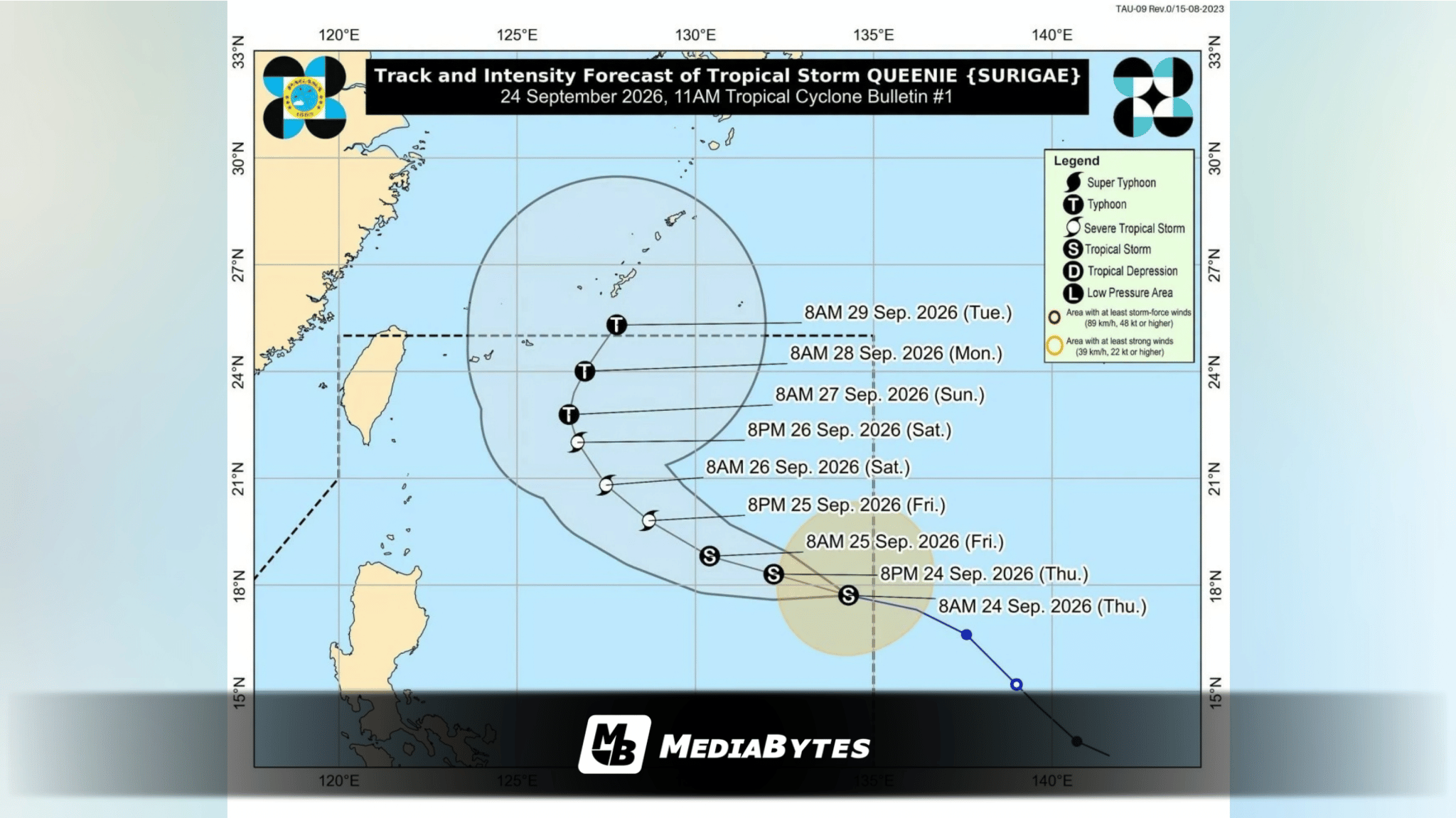
QUEZON CITY, Philippines — Tropical Storm Queenie entered the Philippine Area of Responsibility (PAR) at 7 a.m. on Thursday, September 24, becoming the 17th tropical cyclone to enter the country’s tracking region this year. Current forecasts indicate the system will likely avoid hitting land altogether.
As of 10 a.m., weather forecasters tracked the cyclone’s center at 1,310 kilometers east of Northern Luzon. Queenie is moving west-northwestward at 35 kph, carrying maximum sustained winds of 75 kph near its center and peak gusts reaching up to 90 kph.
State meteorologists predict the storm will sustain its west-northwest trajectory through Friday, September 25, before altering its path to a north-northeast movement by Monday, September 28.
Queenie is expected to exit the PAR by Tuesday morning, September 29. While the storm will maintain its present strength through Friday, experts forecast steady intensification that could elevate it to typhoon status by Sunday, September 27.
Although Queenie poses no direct landfall threat over the next three days, its outer cloud bands may still trigger rain in parts of southern Philippines.
”Yung extension ng kaulapan na associated dito kay Queenie ay meron po bahagyang epekto particularly dito sa northeastern part ng Mindanao at ganoon din sa ilang bahagi ng Davao region. Ibig sabihin may bahagyang kaulapan po dito na posibleng magdulot ng mga pag-ulan,” said PAGASA weather specialist Dr. John Manalo during a press briefing on Thursday.
Dr. Manalo added that the rest of the country, including Metro Manila, should expect clearer skies, though localized afternoon thunderstorms and brief rain showers remain possible. Furthermore, the storm is not expected to pull or reinforce the southwest monsoon (habagat), which has been steadily losing strength.
Weather authorities anticipate declaring the official end of the southwest monsoon within the next two weeks.
Maritime conditions along the eastern seaboard of Northern Luzon are projected to worsen slightly, with moderate seas developing starting Saturday.